
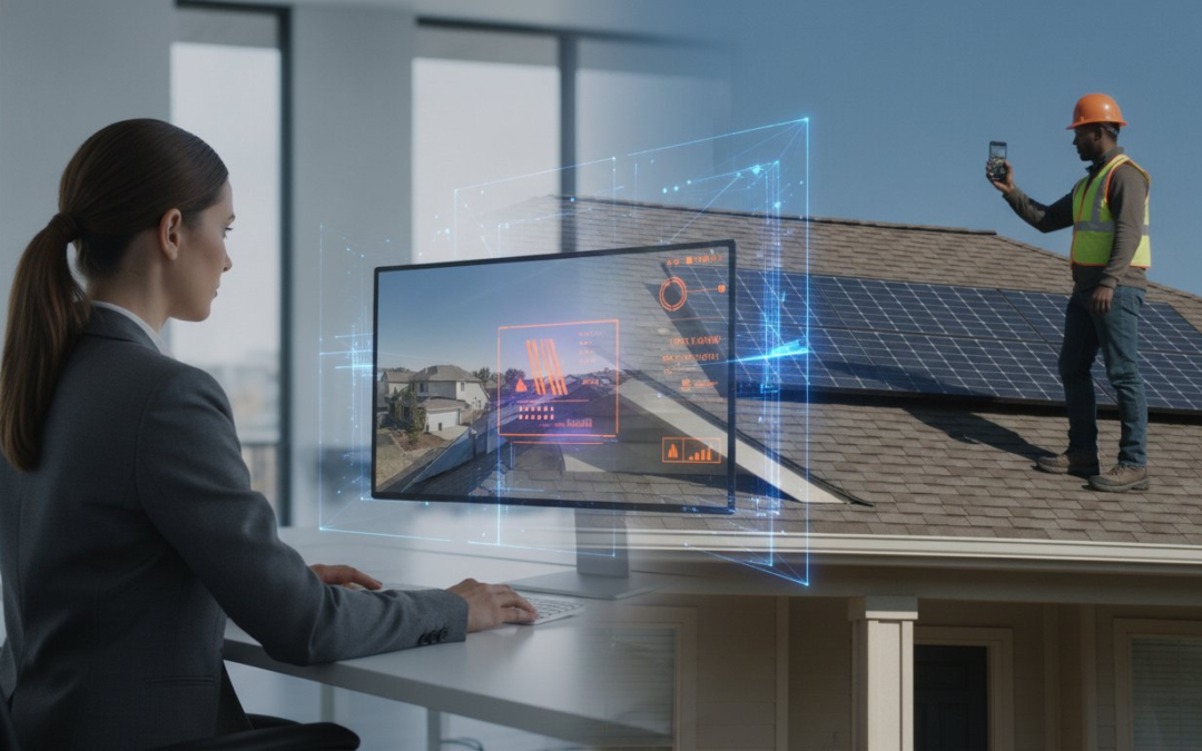
What if you could slash your travel budget by 50% without ever losing eyes on your most critical job sites? It’s a question every field professional is asking in 2026 as fuel costs climb and schedules tighten. You’re likely exhausted from chasing blurry photos sent by on-site assistants or spending your weekends manually labeling hundreds of images. Finding the right tools for remote site inspections isn’t just about convenience; it’s about reclaiming your time and restoring order to the chaos of field documentation.
You deserve a workflow that’s fast, precise, and professional. We agree that the old way of manual reporting is a drain on your resources and your sanity. This guide delivers the essential hardware and software required to conduct thorough inspections from anywhere in the world. Discover how to generate instant reports, standardize your documentation across every site, and meet the latest 2026 OSHA compliance standards with ease. We’ll break down the tech stack that empowers you to see more, do more, and travel less!
Key Takeaways
- Stop losing money on fuel and start maximizing your billable hours with a digital-first inspection strategy.
- Discover why the right tools for remote site inspections are now mandatory for maintaining professional documentation standards in 2026.
- Choose between live streaming and asynchronous capture to keep your projects moving without the “live feed” connectivity trap.
- Build custom templates that automate photo labeling and generate professional reports in seconds, not hours!
- Equip your field teams with the hardware and software needed to capture every detail perfectly on the first try.
Why Remote Site Inspection Tools are Non-Negotiable in 2026
The “drive-by” inspection is dead. In 2026, field professionals don’t have the time or the budget to waste on unnecessary truck rolls. High fuel costs and tight labor markets have made the old-school physical visit a luxury you can’t afford. Modern tools for remote site inspections have transformed the workflow from a physical chore into a digital powerhouse. You aren’t just saving on gas; you’re gaining total control over your documentation.
Consider the math. Industry data shows an extra truck roll for a solar installer costs roughly $475. Compare that to a software subscription. The ROI is immediate. By implementing virtual triage, firms are reducing claim cycle times by as much as 40%. You see the damage, document the facts, and close the file. It’s fast. It’s efficient. It’s profitable! You’re no longer limited by your physical location. You’re empowered by your digital capabilities.
Industry standards have also shifted. Regulatory bodies and insurance carriers now demand the level of precision found in Remote Visual Inspection. Digital evidence is no longer a luxury. It is the baseline for transparency and legal protection in a high-velocity work environment. Meeting these standards requires more than just a smartphone camera; it requires a structured, professional digital-first approach.
The Shift from Physical to Virtual Triage
Stop sending your most expensive experts to every minor site. Remote tools allow one senior adjuster to oversee a dozen junior techs simultaneously. This strategy is a game-changer during disaster response or high-volume events. You maintain rigorous quality control without the travel fatigue. Capture the data. Review the feed. Approve the report. This rhythmic workflow keeps your team moving and your clients happy. It turns a chaotic day into a streamlined success!
Overcoming the “Physical Presence” Bias
The naked eye is fallible; digital documentation is not. High-resolution photos and 360-degree views often reveal details a tired inspector might miss on-site. Address liability concerns head-on with GPS-tagged and timestamped evidence that proves exactly when and where an image was taken. This transparency builds instant trust with your clients. They see exactly what you see. Professional, digital reports restore order to the chaos and eliminate the disputes of the past. It’s about being modern, reliable, and deeply practical.
Essential Categories of Remote Inspection Technology
Success in the field requires a tech stack that works as hard as you do. You don’t need a truckload of expensive gadgets; you need a synchronized system. The right tools for remote site inspections bridge the gap between the physical site and your final report. This ecosystem consists of hardware to see the site and software to organize the evidence. When these components work together, you eliminate the friction that slows down your workday.
- Virtual Inspection Software: This is your command center. It manages the flow of data from the field tech to the desk adjuster in real-time.
- 360-Degree Cameras: Capture an entire room in one click. These cameras eliminate “blind spots” and ensure you never have to ask for a re-shoot.
- UAVs and Drones: Essential for aerial roof and wall measurements. They provide high-resolution data without the safety risks of climbing ladders.
- Augmented Reality (AR) Tools: Annotate issues during a live feed. This allows experts to guide field assistants through complex assessments instantly.
- Automated Documentation Platforms: Stop the manual grind. These platforms turn raw photos into formatted, professional reports in seconds.
Software vs. Hardware: Where to Invest First
Invest in your software first. Your team already carries high-powered smartphones; use them! Mobile-first software turns a standard phone into a professional inspection device. Prioritize platforms that offer cloud-based storage for immediate team collaboration. You can upgrade to specialized hardware like thermal sensors or 360-degree cameras once your digital foundation is solid. Following Best Practices for Remote Virtual Inspections ensures you don’t overspend on gear you won’t use. Focus on the workflow before the hardware!
Integrations with Estimating and Management Suites
Data silos kill productivity. Your remote tools must talk to the platforms you use every day. If your software doesn’t sync with Xactimate or Verisk, you’re just creating more manual work for yourself. Streamline the flow from photo capture to line-item estimating by choosing compatible platforms. Ensure your data is consistent across all field and office devices to avoid construction rework or claim delays. High-efficiency teams use virtual inspection software that automates the labeling process. This makes the transition from field data to a final estimate seamless. Stop fighting your tools and start closing files!
Live Streaming vs. Asynchronous Documentation: Choosing Your Strategy
Don’t get caught in the connectivity trap. Many professionals believe that tools for remote site inspections require a constant, high-definition live video feed. They’re wrong. Relying solely on live streaming is a gamble that rarely pays off in the field. If the signal drops in a basement, a parking garage, or a rural job site, your entire inspection grinds to a halt. You need a strategy that functions when the bars disappear and the clock is ticking.
The secret to a professional workflow is knowing when to go live and when to stay offline. Live streaming is great for “seeing” the site, but asynchronous documentation is how you “report” the site. A hybrid approach ensures you have the visual context of a walkthrough combined with the ironclad evidence of high-resolution, labeled stills. This dual-threat strategy saves bandwidth, protects your data, and keeps your team productive regardless of the local signal strength.
The Case for Live Virtual Inspections
Live streaming has a specific, high-value purpose. It’s the ultimate tool for immediate expert consultation and real-time troubleshooting. Use it when a junior technician encounters a complex mechanical issue or a unique structural failure that requires a senior adjuster’s eyes. Tools like Zoho Lens or Avatour allow you to annotate the screen and guide the hands on-site with AR overlays. It’s fast. It’s direct. It’s collaborative! However, remember the limitation: it demands high-speed internet and perfectly synchronized schedules. If you don’t have both, you’re just staring at a buffering wheel while your profit margin shrinks.
The Power of Organized Asynchronous Reporting
This is where the real work gets done. Asynchronous documentation is the backbone of high-volume, professional operations. Your field tech captures the data, labels the photos using voice-to-text, and syncs everything once they hit a stable Wi-Fi signal. This workflow eliminates the “office night shift” where you spend hours manually naming files and guessing what a blurry photo represents. With a dedicated photo app, you can label evidence while you’re still standing on the roof. Capture, Label, Report. It’s a rhythmic, unstoppable process that keeps your pipeline moving. It turns raw data into a finished product before you even leave the site! Stop waiting for a signal and start documenting the facts with speed and precision.
How to Build a High-Efficiency Remote Inspection Workflow
Efficiency isn’t an accident; it’s a design. Building a high-velocity workflow is about removing every possible roadblock between the site visit and the final invoice. You don’t just need a camera. You need a system that thinks for you. Modern tools for remote site inspections turn a chaotic field visit into a structured data stream. Start by defining your standards. If your field techs are winging it, your reports will suffer. Consistency is the foundation of professional documentation.
Equip your team with mobile tools that handle the heavy lifting of organization. Use a team management dashboard to oversee every project from a single screen. This isn’t just about oversight; it’s about real-time collaboration. When the field tech finishes the last photo, the office should already have the report. This is how you reclaim your time and scale your business! Capture. Label. Close!
Standardizing Your Templates
Stop re-inspecting properties because a tech forgot a crucial shot. Create custom inspection templates for every job type, whether it’s a complex HVAC assessment or a standard roof claim. These templates act as a digital guide, ensuring every tech follows the same path of travel. By making specific photo fields mandatory, you guarantee a complete file every single time. It’s about building a foolproof process that eliminates human error and protects your reputation. Standardize. Streamline. Succeed!
Mastering On-Site Documentation Speed
Manual data entry is a relic of the past. Utilize voice-to-text labeling to document your findings hands-free while you’re still looking at the damage. This simple shift can save you 30 minutes per inspection. Automated labeling instantly converts visual evidence into structured data, stripping away the need for tedious manual file naming and sorting. It’s the ultimate time-saver for the modern professional.
Don’t wait until you get back to your truck to start the paperwork. Generate an instant photo report before you even leave the site. This immediate action keeps your momentum high and your backlog low. To see this in action, get started with the PHOTO iD mobile app and transform your field operations today. Sync everything to your dashboard and let the software handle the organization while you move to the next job. Speed. Precision. Profit!
Elevate Your Field Reports with PHOTO iDs Virtual Tools
The manual grind of office work shouldn’t be the price you pay for a day in the field. You’ve seen how the right tools for remote site inspections can slash travel costs and improve accuracy. Now, it’s time to choose a partner that turns those digital capabilities into a competitive advantage. PHOTO iD isn’t just an app; it’s a game-changing partner that restores order to the chaos of onsite documentation. Stop naming files manually and start closing claims with speed and precision!
Our virtual inspection software is designed specifically for the professional adjuster’s workflow. It understands the pressure of a high-volume schedule and the need for ironclad evidence. With automated photo labeling, your images are organized the moment you snap the shutter. You don’t have to guess where a photo was taken or what it represents. The software handles the heavy lifting, allowing you to focus on the assessment. Capture. Label. Close! This is the rhythmic efficiency that modern field professionals demand.
Don’t let your documentation sit in a digital pile for days. Generate an instant photo report and go from a site visit to a professional PDF in seconds. Every report is standardized, polished, and ready for review before you even start your truck. With the team management dashboard, office staff can see field projects in real-time. This level of transparency eliminates bottlenecks and keeps your entire operation moving forward with constant momentum.
Professional Features for Serious Inspectors
Precision matters when your reputation is on the line. We’ve integrated aerial roof and wall measurements directly into your documentation process to ensure total accuracy. Use the custom report builder to maintain your brand’s look and feel on every document. If your hands are full, our voice-to-text labeling is the fastest way to document findings without slowing down. It’s about being tech-savvy, reliable, and deeply practical in every environment. Document. Detail. Deliver!
Seamless Integration and Collaboration
Your data shouldn’t live in a silo. PHOTO iD bridges the gap between field photos and industry-standard estimating suites like Xactimate. This seamless flow ensures that your documentation supports your line-item estimates without any manual data re-entry. Whether you’re a solo professional or managing a massive team, our centralized project management tools keep everyone on the same page. It’s time to stop fighting your workflow and start mastering it. Try PHOTO iD today and transform your inspection workflow to see the immediate impact on your productivity and your bottom line!
Take Control of Your Field Documentation
The future of field work isn’t about more travel; it’s about better technology. You’ve seen how the right tools for remote site inspections can slash your fuel expenses and eliminate the “office night shift” of manual photo labeling. By choosing a workflow that prioritizes asynchronous capture and automated reporting, you restore order to the chaos of your job site. It’s time to stop chasing blurry photos and start delivering professional, standardized reports that build instant trust with your clients.
PHOTO iD is designed by industry veterans who understand the daily grind of specialized labor. Our platform is trusted by thousands of field professionals because it automates the most tedious parts of documentation. You deserve a partner that works as fast as you do. Don’t let manual data entry slow your growth or drain your profits. Capture. Label. Close!
Ready to reclaim your time and scale your operation? Start Your Free Trial of PHOTO iD Now and experience the speed of automated reporting! It’s fast. It’s reliable. It’s the professional edge you need in 2026.
Frequently Asked Questions
What are the best tools for remote site inspections in 2026?
The best tools for remote site inspections in 2026 combine mobile-first software with high-performance hardware like drones and 360-degree cameras. Prioritize platforms that offer automated labeling and instant report generation. These tools ensure that your data is organized, accessible, and professional. Focus on a tech stack that emphasizes speed, accuracy, and seamlessness!
Can I perform a remote inspection without a high-speed internet connection?
Yes, you can perform inspections in low-signal areas by using asynchronous documentation strategies. Capture your photos and data offline while you are on-site. The software will automatically sync your files once you return to a stable Wi-Fi connection. This approach prevents “dead zone” delays. Capture the data. Save the file. Sync when ready!
How does automated photo labeling speed up the inspection process?
Automated photo labeling eliminates the need for manual file naming and sorting after you leave the site. By using voice-to-text during the walkthrough, your findings are documented instantly. This simple shift can save up to 30 minutes per inspection. It ensures your reports are ready for immediate review without the office night shift.
Do I need a 360-degree camera for professional remote inspections?
A 360-degree camera is not strictly required, but it is highly recommended for capturing full environmental context in a single click. Most professional inspections can be completed using a high-quality smartphone equipped with dedicated virtual inspection software. Start with the software first. Upgrade your hardware as your volume grows. Build a foundation that is modern, reliable, and practical.
Is remote inspection software compatible with estimating tools like Xactimate?
Yes, professional remote inspection software is designed to integrate seamlessly with estimating suites like Xactimate and Verisk. This compatibility allows you to move field data directly into your line-item estimates. It eliminates manual re-entry and reduces the risk of construction rework. Streamline the flow. Sync the data. Close the file!
What is the difference between virtual inspection and remote video inspection (RVI)?
Virtual inspection refers to the broad digital workflow of documenting a site remotely through apps and cloud platforms. Remote Visual Inspection (RVI) often focuses on using specialized tools like borescopes or drones for technical visual access. Both are essential parts of a modern tech stack. They work together to provide a complete site overview from your desk.
How can I ensure the accuracy of aerial measurements taken remotely?
Ensure accuracy by using high-resolution drone imagery paired with software specifically designed for aerial roof and wall measurements. These tools provide precise data that replaces the safety risks of manual measuring. Always verify that your drone operations comply with current FAA Part 107 or Part 108 regulations. Measure. Document. Deliver!
Can remote inspection tools help reduce my liability as an inspector?
Remote inspection tools reduce liability by creating an ironclad digital paper trail for every job. Every photo is GPS-tagged and timestamped to prove the exact time and location of the assessment. This standardized documentation protects you against disputes and ensures total transparency with your clients. Document. Tag. Protect. It is the ultimate way to restore order to the documentation process!