
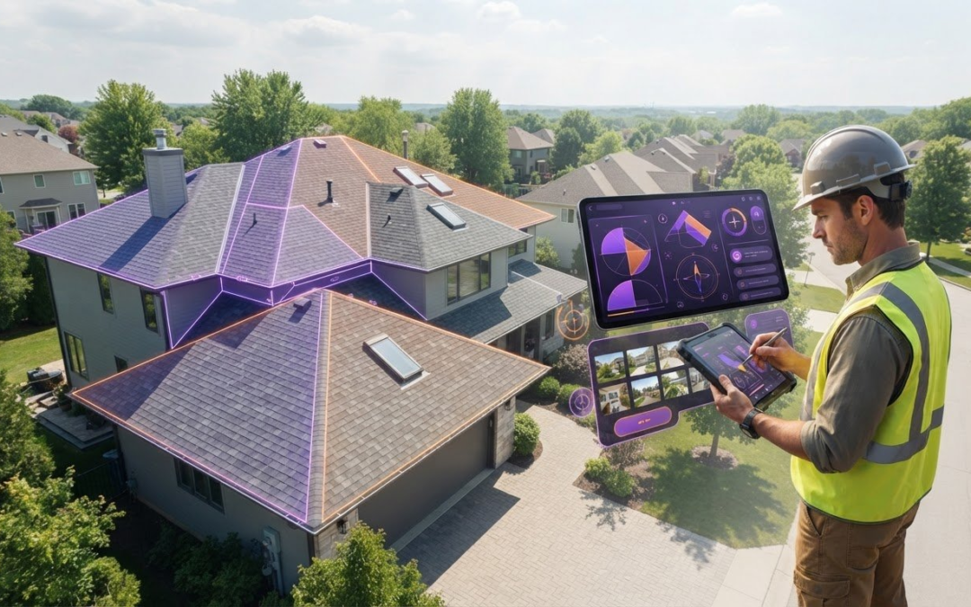
What if a measurement that saves you a site visit still leaves your estimate short on context? An aerial roof measurement app can provide roof dimensions, but dimensions alone may not show the conditions your crew needs to document. Clear photos, field observations, and an organized handoff matter too.
Scattered measurements and jobsite photos slow down estimating and create avoidable confusion. The key is to understand what each tool does: a measurement app provides access to roof dimensions, a report delivers measurement information for a property, and documentation software organizes photos and observations around the job.
This guide explains how to compare those roles, choose a workflow for the property and your team, and connect measurement context with organized jobsite documentation. PHOTO iD supports aerial roof and wall measurements, sketch measurement report access, an in-camera compass and roof-pitch gauge, labeled photos, and photo reports. Use these tools to bring measurement context and field observations together for a clearer handoff.
Key Takeaways
- Choose an aerial roof measurement app by matching its measurement access and outputs to the demands of each job.
- Build a consistent workflow from property identification to measurement review, condition documentation, and a complete job record.
- Compare tools across imagery context, field documentation, reporting, and collaboration, not just how they provide measurements.
- Use measurements as one part of the picture. Visible site conditions and job requirements shape how useful they are.
- PHOTO iD brings measurement context and jobsite documentation together with photo management and reporting tools.
What an Aerial Roof Measurement App Does for Roofing Teams
An aerial roof measurement app gives a crew a digital way to access or work with roof measurement information. Depending on the tool, the information may come from existing aerial imagery, imagery captured for a specific property, or another measurement workflow. Some methods use photogrammetry, which derives measurements from photographs. Apps can use different imagery sources and provide different outputs, so compare what each one actually delivers.
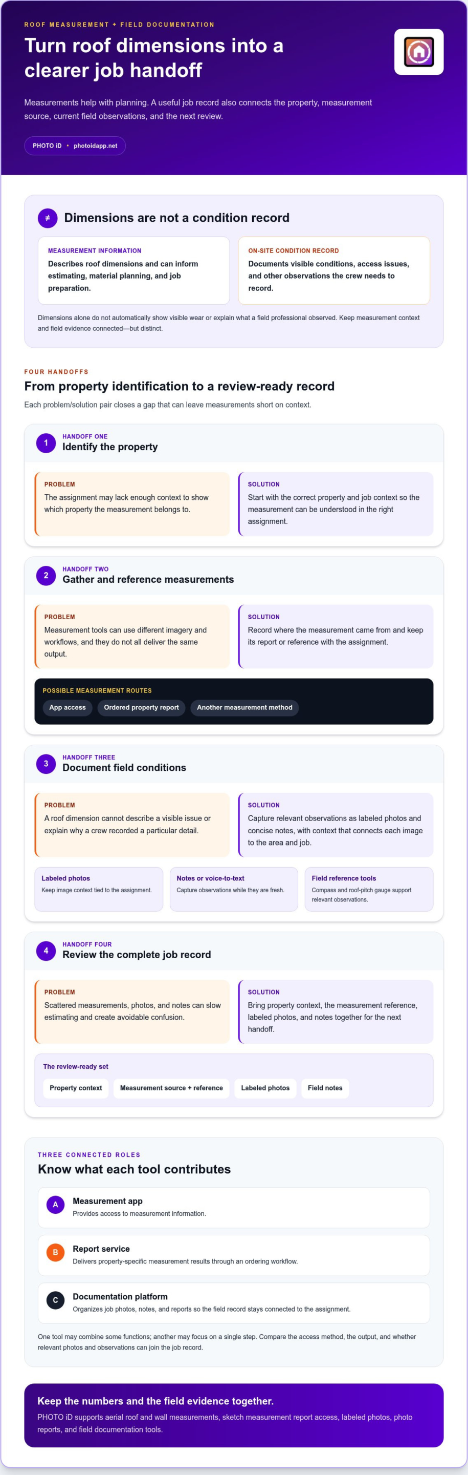
Measurement data describes roof dimensions; an on-site condition record documents what the crew observes at the property. Keep that distinction clear. Dimensions can inform an estimate and material planning, but they don’t automatically show visible wear, access issues, or other conditions a field professional may need to record. Measurements and jobsite documentation solve related but different problems.
Aerial measurement app, report service, or documentation platform?
Think of these as three connected roles, not interchangeable labels. A measurement app provides access to measurement information. A report service delivers property-specific results through an ordering workflow. A documentation platform organizes job photos, notes, and reports so the field record stays connected to the assignment.
One tool may combine some of these functions, while another focuses on a single step. Check how measurement information is accessed, what output you receive, and whether the job record can include relevant photos and observations. This makes it easier to distinguish a measurement deliverable from a complete field workflow.
What roof measurements can help a crew plan
Roof dimensions can give estimators a starting point for preparing an estimate, planning materials, and organizing job preparation. Their usefulness depends on the property, the measurement output, and the work being planned. Use dimensions as planning information, then document visible conditions separately when the job calls for a current on-site record.
PHOTO iD supports aerial roof and wall measurements, along with sketch measurement report access. Its broader role is photo management for inspections and field service work. Crews can keep labeled jobsite photos and photo reports connected to the assignment, adding visual context around measurement information instead of leaving it scattered across devices or jobs.
Use a simple handoff: add measurement information to the job record, capture relevant observations in the field, and keep both organized for review. Estimators and office teams can then see the measurement context alongside documented conditions, making the record easier to understand and act on.
How Aerial Roof Measurements Fit into a Jobsite Workflow
Measurements become more useful when the crew can connect them to the right property, current field observations, and a job record the office can review. Build the workflow around those handoffs, not around a measurement file alone. Depending on the selected tool, a team might access measurements in an app, order a property report, or use another method.
Use this sequence to keep the information connected:
- Identify the property. Start the assignment with the correct property and job context.
- Gather measurements. Record where the measurement information came from and keep its report or reference with the assignment.
- Document conditions. Capture relevant field observations as labeled photos and notes.
- Review the job record. Bring the measurement context and field documentation together for the next handoff.
Start with the property and the measurement source
Before using dimensions for planning, confirm that the assignment points to the intended property. Note whether the measurements came through an app, an ordered report, or another source. That context helps the next person understand what they’re reviewing instead of treating a number or document as self-explanatory.
Keep the measurement output with the job record, distinct from observations made on site. This helps the team revisit how the dimensions were obtained or compare them with field evidence. Don’t assume every aerial roof measurement app uses the same imagery or delivers the same output.
Connect measurements with field observations
At the property, capture conditions relevant to the work as labeled photos and concise notes. A dimension can support planning, but it doesn’t describe a visible issue or explain why a crew recorded a particular detail. Label each image with useful job context so office staff can connect the evidence to the right area and assignment.
When typing is awkward in the field, voice-to-text labeling can help capture context while the observation is fresh. PHOTO iD supports voice-to-text labeling, real-time image labeling, photo reports, and team collaboration. These features help crews organize documentation around an assignment and share context with colleagues. Use the in-camera compass or roof-pitch gauge to document relevant observations, without treating either as a substitute for job-specific evidence.
Before handing off the record, review it as a set: property context, measurement reference, labeled photos, and notes. PHOTO iD’s field photo documentation tools help keep that information organized for team review. A clear record makes the next step easier to understand, whether it’s estimating, planning, or following up on a field observation.
Compare Aerial Roof Measurement Apps with Reports and Estimating Tools
Compare the work each tool handles, not just the label on its website. An aerial roof measurement app may provide access to measurement information, while a report service may deliver a property-specific report through an ordering process. Documentation software focuses on organizing field evidence. Estimating tools may support other steps, but their outputs and capabilities vary by product.
| Tool type | Measurement access | Imagery context | Field documentation | Reporting and collaboration |
|---|---|---|---|---|
| Measurement-enabled app | Measurement information may be accessible or usable within the app. | Imagery source and context depend on the product. | May be limited or included, depending on the tool. | Check what can be reviewed or shared with the team. |
| Ordered report service | Provides property-specific outputs through an ordering workflow. | Report context depends on the service and its deliverable. | Field photos and observations may need a separate workflow. | Review the report format and how the team accesses it. |
| Documentation platform | May support measurements or keep measurement references with an assignment. | Organizes the field team’s own job photos and observations. | Designed to organize photos, notes, and job records. | Reporting and team collaboration depend on platform features. |
| Estimating tool | May use measurement information as one input to estimating. | Context and imagery support vary. | May not be the main place for field documentation. | Outputs may include estimate-related materials, depending on the tool. |
Don’t assume an ordered report is the same as an in-app measurement feature. Treat material lists, waste factors, delivery times, and visualizers as product-specific capabilities, not standard features across the category. Compare the actual output with what your crew and office need for the job.
Choose the tool type that matches the job
Choose report ordering when the job calls for a property-specific measurement deliverable. Choose a measurement-enabled app when the team needs measurement access within its field workflow. Add a documentation platform when labeled photos, observations, and organized team records are priorities. Some workflows combine these roles; others use separate tools. Start with the required job output, then map each tool to its role.
Compare outputs, access, and team handoffs
Check whether the tool gives your team the measurement output it needs, and whether it can be accessed in the field and reviewed in the office. Then compare reporting, sharing, and collaboration: can the crew keep useful photo context with the assignment, and can colleagues follow the record? PHOTO iD supports aerial roof and wall measurements, sketch measurement report access, photo reports, and team collaboration. It connects measurement context with the documentation workflow.
For a wider view of how roofing software fits together, explore this 2026 roof software guide. Keep your comparison practical: match the deliverable, field record, and handoff to the demands of the work.
Are Aerial Roof Measurements Enough? Check Context Before You Rely on Them
A measurement is useful only in the context of the job. Its value depends on the property and roof areas represented, the imagery available, the output provided, and the conditions visible at the site. A result may help with planning, but it doesn’t automatically describe changes that occurred after imagery was captured or details that aren’t visible in the deliverable. Don’t treat a measurement as a complete account of current site conditions.
Before using measurements for planning, review the property match, roof areas shown, imagery context, measurement output, visible changes, and any access limitations.
Review measurement context and visible conditions
Start by checking that the property and roof sections in the measurement information correspond to the assignment. Look for context that could affect how the dimensions apply to the work, such as a visible addition or an area that isn’t represented clearly. If the team observes a change or limitation at the site, record it rather than assuming the measurement source reflects it.
This is a practical review, not a structural or condition assessment. Measurements describe dimensions within the scope of their source and output. They don’t establish the roof’s condition or replace a qualified evaluation when the work requires one. Keep those tasks distinct in the job record so a planning reference isn’t mistaken for a conclusion about the roof.
Preserve a clear record when details need review
If a field observation appears to differ from the measurement context, make the discrepancy easy for the next person to understand. Capture a relevant photo, label it with the area or observation, and add a concise note explaining what needs review. Avoid relying on an unlabeled image or a verbal handoff that can lose context as the assignment moves between field and office.
Keep the measurement reference, labeled photos, and notes together in the assignment record. This gives the team a clear basis for reviewing the issue and deciding what information is useful for planning. PHOTO iD supports labeled photos, photo reports, and team collaboration, helping keep documentation organized alongside measurement context. Use its in-camera compass or roof-pitch gauge to record relevant observations, without treating those tools as verification of aerial dimensions.
For practical guidance on using these tools in a field workflow, review the aerial roof and wall measurement safety guide. Build a job record that makes context visible, not just the final measurement. Organize roof measurements with field photos using PHOTO iD’s documentation tools.
Use PHOTO iD to Keep Roof Measurements and Job Photos Together
PHOTO iD is a photo management solution that supports aerial roof and wall measurements. It also provides sketch measurement report access, an in-camera compass, and a roof-pitch gauge. Use these capabilities to keep measurement context close to the field record. The goal is an organized assignment, with information and observations that are easy for the team to review.
Bring measurement context into a photo-first assignment
Start an assignment with the property context, then organize relevant job photos and observations around it. Real-time image labeling helps identify what each photo shows, while voice-to-text labeling gives field teams another way to add context as they work. Customizable inspection templates can guide repeatable documentation, helping crews capture the information their process calls for across assignments.
Keep the handoff moving. PHOTO iD supports remote capture, team chat, and secure shareable assignment links, so colleagues can contribute to or review project information. For example, a field team can use labeled photos to explain an observation alongside measurement context, while office staff follow the assignment record. The compass and roof-pitch gauge can also support documenting observations without overstating what those tools establish.
Move from field capture to a shareable report
Build the record from the information the job needs, then prepare it for review. PHOTO iD supports unlimited photo and video capture, unlimited cloud storage, and unlimited photo reports. Digital signatures, document scanning, and PDF building can help bring additional job documentation into a shareable format. Together, these tools support a photo-first workflow around measurement information.
- Capture: Add job photos, videos, and relevant documentation to the assignment.
- Organize: Label images in real time, use voice-to-text, and follow a custom template.
- Collaborate: Use team chat and shareable assignment links to keep people aligned.
- Share: Create a photo report or build a PDF for the next handoff.
This structure helps reduce the gap between field capture and office review. Instead of searching through a camera roll for the image that explains a note, the team can refer to organized job documentation connected to the assignment. For a broader look at field documentation workflows, explore this home inspection app guide.
If your team wants measurement context and field documentation organized in one workflow, explore PHOTO iD’s photo management tools. Use them to support the documentation around roof measurements and keep the job record clear for the next handoff.
Build a Field Workflow Your Team Can Trust
Choose an aerial roof measurement app as one part of a dependable job record, then make the next step easier for everyone who handles the assignment. PHOTO iD has supported more than 1 million property inspections and captured more than 20 million images. The platform brings aerial roof and wall measurements and sketch measurement report access into a photo management workflow, with real-time photo labeling to keep field context clear.
Keep the handoff moving with team collaboration, shareable assignment links, unlimited photo and video capture, cloud storage, and photo reports. Give the office more than dimensions alone: provide organized documentation that helps colleagues understand what the field team observed and what needs attention next.
Set a consistent approach for capturing, labeling, and sharing jobsite information, then put it to work across your team. Explore PHOTO iD and simplify jobsite photo management with connected field documentation.
Frequently Asked Questions
Can I use Google Earth to measure a roof?
Yes, Google Earth’s measurement tools may help estimate dimensions from available map imagery, but treat the result as a preliminary reference, not a roof-specific measurement report. Image clarity, viewing angle, and the visible roof outline can affect what you can measure. Trees or shadows, for example, may obscure an edge. Compare any estimate with job requirements and field observations before using it to plan materials or prepare a detailed estimate.
Do I need a drone to use an aerial roof measurement app?
No, a drone isn’t required for every aerial measurement workflow. Some services create measurements from existing aerial imagery, while drone-based workflows use imagery captured at the property—often handled by certified aerial specialists like TDB Solutions. The source depends on the tool and the job. Aerial roof measurement apps and photo documentation platforms can serve different roles, so identify whether you need measurement access, custom imagery, or organized field records before choosing a workflow.
Can aerial roof measurement apps work on every property?
No single workflow suits every property. Imagery may be unavailable, outdated, obscured, or difficult to interpret for a particular roof. Complex roof shapes or recent additions can also make a remote measurement less useful for the task. If the property record doesn’t clearly represent the roof area you need, note the limitation and gather additional job-specific information before relying on the result.
Can I use aerial roof measurements for an insurance claim?
They may help document roof dimensions, but whether a measurement report is suitable for a particular claim depends on the claim’s documentation requirements. Don’t treat dimensions as proof of damage or as an assessment of roof condition. Keep the report with dated, labeled photos and relevant observations, and follow the documentation process specified for the claim. PHOTO iD supports photo organization and reporting, not insurance claim adjusting.
How often should roof measurement information be updated?
Update it when the property or job context changes enough to affect planning. Examples include a roof addition, a major alteration, or a new project using older measurement information. There isn’t one update interval that fits every property and workflow. Record when the information was obtained, then compare it with current job details before reusing it so the team can spot when a fresh measurement reference may be needed.
Can an aerial roof measurement app help with a roofing estimate?
Yes, an aerial roof measurement app can provide dimension information that helps inform an estimate, but it shouldn’t be the only input. Estimators also need job-specific scope and relevant observations. A measurement may help with roof-area planning, while labeled field photos can clarify a visible feature that affects the proposed work. Keep the measurement reference and supporting documentation accessible together for review.
What should I do if an aerial measurement does not match what I see onsite?
Pause before using the conflicting figure to finalize planning. Confirm that the measurement and assignment refer to the same property and roof area, then capture a labeled photo of the relevant site condition and add a concise note describing the mismatch. Keep the original measurement context with the assignment instead of silently replacing it. This gives colleagues a clear record to review and helps guide the next measurement or planning step.
Can roof measurement information be shared with a crew or client?
Yes, sharing depends on the tool and the way its outputs are provided. A report may be shared as a document, while a documentation platform can connect measurement context with job photos and assignment details. PHOTO iD supports team collaboration and shareable assignment links, helping teams review organized job information. Before sharing externally, make sure the recipient can access the chosen format and that the assignment contains only relevant project material.
Bring roof measurement context and field photos into a clearer job record with PHOTO iD’s photo management tools.