
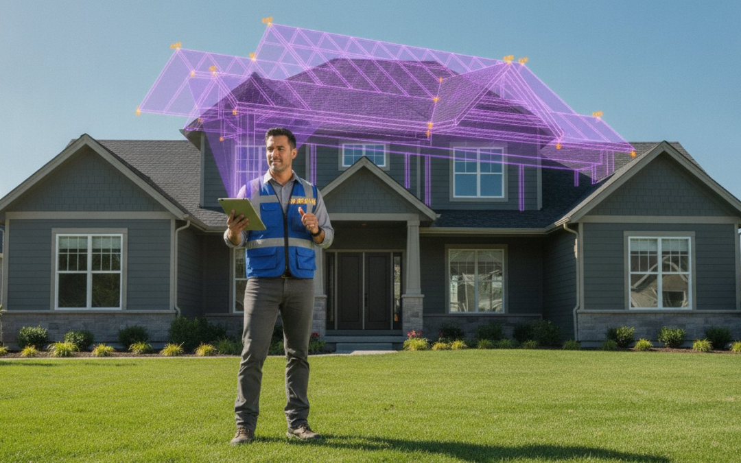
The most dangerous part of your workday shouldn’t be the first five minutes spent on a ladder. If you’re still manually pulling tape and scribbling dimensions on a clipboard, you’re bleeding time, risking injury, and inviting human error into your estimates. It’s time to stop the climb. By leveraging aerial roof and wall measurements, you can transform your entire inspection process from a physical grind into a high-velocity digital workflow. With over 35% of residential roof claims going drone-assisted by 2026, staying manual means falling behind. Accuracy is the backbone of every successful claim, and every minute spent on a roof is a minute of unnecessary liability.
Master the technology behind remote property measurements to eliminate manual climbing, slash inspection times, and produce claim-ready reports with pinpoint accuracy. We’ll explore how PHOTO iD integrates these digital takeoffs directly into your documentation. You’ll learn to capture data, sync photos, and generate reports in one seamless motion. Get ready to accelerate your claim cycles, reduce your insurance costs, and project the professional authority your clients expect. Let’s build a faster, safer, and smarter way to work!
Key Takeaways
- Eliminate dangerous ladder climbs and manual errors by switching to AI-powered 3D property modeling for faster, safer estimates.
- Master the precision of aerial roof and wall measurements to identify obstructions like chimneys and skylights with pinpoint accuracy.
- Capture the full scope of restoration projects by including wall data for accurate siding, masonry, and paint bids.
- Streamline your workflow by syncing remote measurement reports directly with your on-site photo documentation in PHOTO iD.
- Scale your business using a centralized dashboard to track multi-property orders and slash your total claim cycle times.
What Are Aerial Roof and Wall Measurements?
Forget the tape measure and the precarious ladder lean. Aerial roof and wall measurements represent the transition from manual labor to digital precision. These measurements are property dimensions derived from high-resolution satellite, aircraft, or drone imagery. By feeding this imagery into AI-powered 3D property modeling, software generates a comprehensive digital twin of any structure. This isn’t just a bird’s-eye view; it’s a sophisticated data set that captures square footage, pitch, facet detail, and total wall surface area with surgical accuracy.
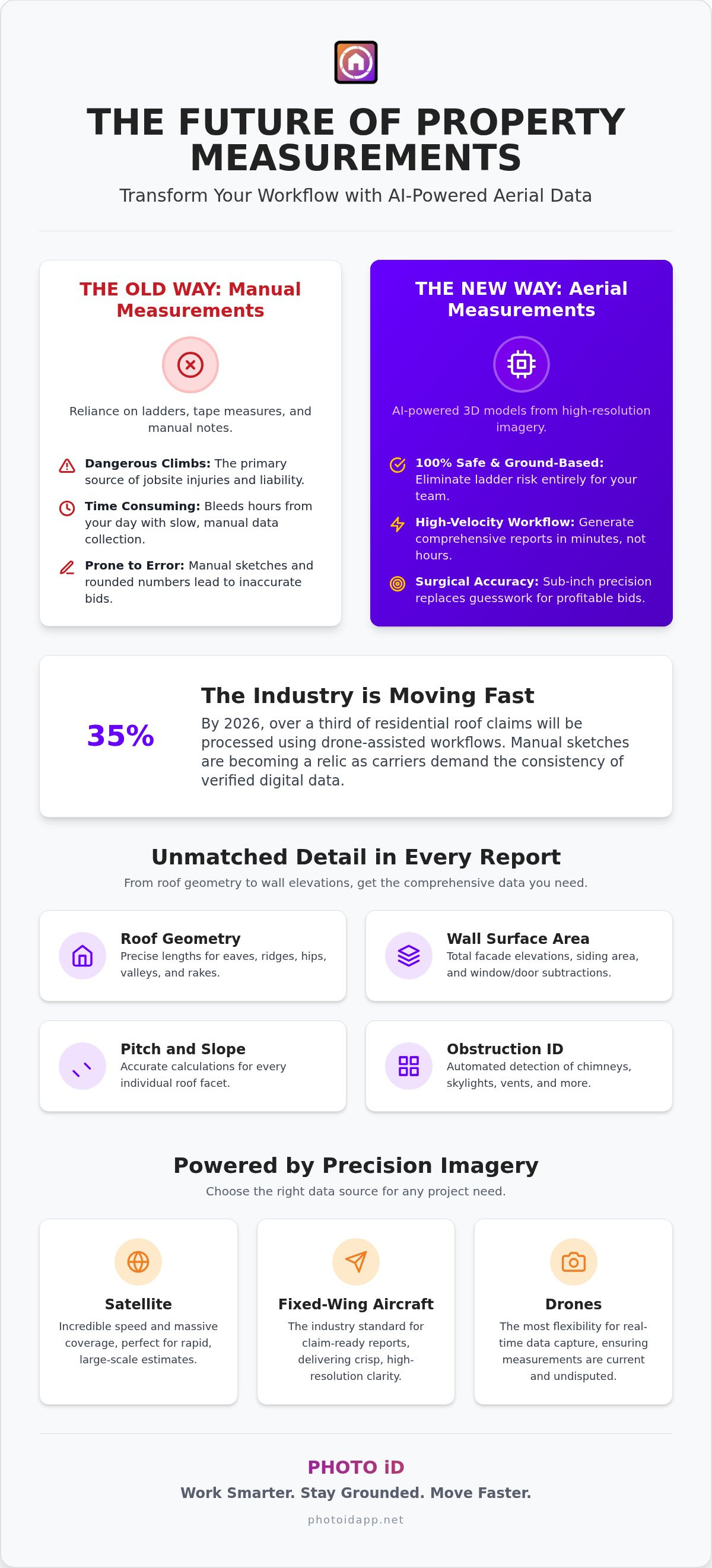
The industry is moving fast. By the end of 2026, leading insurance carriers are expected to process more than 35% of residential roof claims using drone-assisted workflows. This shift isn’t just about convenience. It’s about compliance. Modern standards now require verified digital data for carrier approval, making manual sketches a relic of the past. If you want your estimates accepted without friction, you need the transparency and consistency that only digital modeling provides.
The End of the Manual Climb
Safety is the most immediate win. Eliminating the need to walk every roof facet removes the primary source of jobsite injuries and liability. Beyond safety, you gain incredible precision. Manual error rates, often plagued by rounded numbers and missed angles, are replaced by sub-inch accuracy. This level of detail allows for “desk adjusting” and virtual inspections. You can assess the property, calculate materials, and finalize a claim-ready report without ever leaving your vehicle or office. It’s about working smarter, staying grounded, and moving faster!
Key Data Points Included in Professional Reports
A professional aerial report delivers a level of detail that manual methods simply can’t match. It breaks the property down into actionable components:
- Roof Geometry: Precise lengths for eaves, ridges, hips, valleys, and rakes.
- Wall Surface Area: Total facade elevations, including siding area and specific window or door subtractions.
- Pitch and Slope: Accurate calculations for every individual facet, replacing the need for digital inclinometers.
- Obstruction Identification: Automated detection of chimneys, skylights, and vents to ensure material orders are exact.
Stop guessing and start knowing. Using aerial roof and wall measurements ensures that your bids are based on reality, not estimates. This precision protects your profit margins and builds trust with every stakeholder in the restoration process. Capture the data, sync the report, and close the claim. It’s that simple.
Maximizing Accuracy with Precision Aerial Data
Accuracy isn’t just a goal. It’s your reputation. In the world of property claims, a three-inch error can cascade into a massive material shortage or a rejected supplement. Precision starts with the source of your imagery. Not all pixels are created equal. High-velocity estimating requires a deep understanding of how your data is captured and processed. Relying on precision aerial roof and wall measurements means you stop guessing and start winning.
Satellite vs. Drone vs. Fixed-Wing Imagery
Choosing the right imagery source depends on your project needs. Satellite imagery offers incredible speed and massive coverage. It’s perfect for rapid, large-scale estimates across multiple zip codes. However, resolution limits can sometimes obscure fine details on complex rooflines. For claim-ready reports, fixed-wing aircraft imagery remains the industry standard. These aircraft fly at lower altitudes than satellites, delivering the crisp, high-resolution clarity required for sub-inch precision.
Drones provide the most flexibility for the modern field professional. By using your own hardware, you can capture real-time data that accounts for recent property changes. This local control ensures your aerial roof and wall measurements are current and undisputed. Whether you rely on a third-party provider or fly your own drone, the goal is the same: verified data that eliminates guesswork. AI doesn’t blink. While a manual inspector might miss a small roof facet or miscalculate the area around a chimney, AI-driven 3D modeling identifies every obstruction with ease.
The Impact of Oblique Imagery
Depth matters. While top-down views give you the footprint, oblique imagery provides the perspective. These angled shots, typically taken at 45 degrees, allow the software to calculate wall heights, facade elevations, and pitch with extreme accuracy. This is the secret to building a true 3D model that reflects the physical reality of the structure. This rich data set feeds directly into specialized roof software, turning raw images into actionable reports.
Don’t let supplements slow you down. By using high-resolution oblique data, you prove the scope of work before the first shingle is pulled. This transparency builds instant trust with carriers and homeowners alike. If you want to see how this data integrates with your daily inspections, you can explore professional documentation tools that bridge the gap between measurements and photos. Skylights, vents, and complex valleys are mapped with surgical precision, ensuring your material orders are exact and your profit margins stay protected!
Why Wall Measurements are the Missing Piece of Your Estimate
Roof data is essential, but it only tells half the story. If you’re handling a full restoration project, ignoring the vertical surfaces is a recipe for missed revenue and material shortages. Professional aerial roof and wall measurements provide the complete envelope of the property. This data allows you to generate hyper-accurate bids for siding, paint, and masonry without ever touching a tape measure. You’re not just estimating a roof; you’re documenting the entire asset. It’s about capturing every detail, every angle, and every opportunity for profit.
One of the most powerful features of modern digital modeling is the automated subtraction of openings. The software identifies every window and door, subtracting their surface area from the total facade elevation. This gives you a net square footage that is ready for material orders. No more over-ordering siding or under-estimating paint. You get the exact numbers you need to protect your margins and impress your clients with precision. It turns a complex calculation into a simple, digital result.
Siding and Exterior Restoration
Ordering materials with zero waste is the hallmark of a high-velocity pro. Aerial elevation data provides the exact dimensions for complex trim, fascia, and soffit work. Beyond just material counts, this data plays a critical role in water mitigation and moisture mapping. By understanding the exact surface area of every wall facet, you can accurately plan for waterproofing and structural repairs. You’ll know exactly how many squares of siding to order before the crew even arrives. It’s about seeing the whole picture, identifying the risks, and providing a solution that sticks!
Gutter and Downspout Precision
Stop risking your safety just to check a gutter run. You can now calculate the exact linear footage for gutters directly from your mobile device. Aerial data doesn’t just give you length; it provides the context needed for smart downspout placement based on roof drainage patterns. You can visualize how water moves off the roof facets and onto the walls, ensuring your drainage plan is flawless. Aerial wall data ensures gutter slope accuracy for every install by providing the precise vertical drop needed across every facade elevation. It’s fast, it’s safe, and it’s undeniably professional.
How to Integrate Aerial Data into Your Claims Workflow
A standalone measurement report is just a piece of paper until it’s integrated. To achieve high-velocity estimating, you must bridge the gap between raw data and your final report. Stop treating aerial roof and wall measurements as isolated files. Instead, make them the engine of your digital documentation. This workflow eliminates double entry, reduces friction, and ensures every claim is ready for carrier review in record time. It’s about building a bridge from the physical property to the digital estimate in one smooth motion.
Follow these four steps to modernize your process and reclaim your schedule:
- Order: Generate your report directly through your mobile inspection app while you’re on-site or en route to the property.
- Sync: Connect the measurement data with your live photo documentation to create a single, undeniable source of truth.
- Export: Move your ESX or XML files directly into your estimating platform without any manual data entry or sketching.
- Label: Use automated tools to tag specific photos to the corresponding measured facets instantly for maximum clarity.
Mastering the Digital Export
Manual sketching is a relic of a slower era. When you export an industry-standard data file, it populates the sketch interface in your estimating software automatically. This single step saves hours of clicking, dragging, and correcting. You get a perfect 3D model of the roof and walls with zero manual input. Speed is the game, and automation is the only way to win! By utilizing these seamless exports, you ensure that your digital takeoffs are formatted perfectly for immediate adjuster review and approval.
Connecting Photos to Measurements
Data without proof is just a guess. A measurement report tells the carrier “how much,” but your photos tell them “why.” You need to connect these two worlds to prove your loss. Use voice-to-text features to label photos that correspond to specific measured roof facets as you walk the property. This creates a unified report where the measurement and the damage appear in one clear view. Carriers love this transparency. It virtually eliminates pushback on your estimates and builds instant credibility. Ready to revolutionize your field work? Start your PHOTO iD subscription today and master the high-velocity digital workflow!
Scale Your Business with PHOTO iD’s Integrated Measurements
Stop juggling five different apps. You don’t need a separate tool for measurements, another for photos, and a third for team tracking. Consolidate your workflow and eliminate the noise. PHOTO iD acts as your central command center. It is the only platform that merges the “how” of photo documentation with the “what” of aerial roof and wall measurements. Restore order to the chaos of onsite documentation and scale your business with confidence! This is where technological efficiency meets professional authority.
By positioning PHOTO iD as your central hub, you remove the friction that slows down your growth. You gain a seamless photo-to-report workflow that keeps your data organized and your team moving. Don’t let your documentation live in silos. Bring your measurements, your labeled photos, and your team management into one high-velocity environment. It is time to work smarter, move faster, and lead the industry with digital precision.
High-Velocity Documentation for Teams
Managers need total visibility. The Team Management Dashboard provides a real-time view of your entire operation. You can track multi-property aerial orders and oversee field photos as they are captured. Stop the endless back-and-forth between the field and the office! You can now verify progress from any device, ensuring that every inspector follows the same high standard. Maintain total consistency across every report with custom inspection templates tailored to your specific needs. This isn’t just software; it’s a game-changing partner that keeps your entire team in sync and your overhead low.
From Site Visit to Final Report in Minutes
Experience the PHOTO iD Advantage. Use voice-to-text labeling to document damage while your aerial data syncs in the background. You can close claims 40% faster by eliminating manual data entry and redundant uploads. This high-velocity approach turns a grueling site visit into a streamlined digital result. Your Instant Photo Report combines precise aerial roof and wall measurements and labeled photos into one claim-ready document that carriers can’t ignore. It’s about productivity, speed, and seamlessness in every click. PHOTO iD transforms aerial measurements from a static PDF into an actionable, integrated field tool that drives every step of your inspection. Capture the data. Sync the report. Scale the business!
Master Your Digital Workflow!
The days of manual tape pulling and risky ladder climbs are over. By embracing aerial roof and wall measurements, you protect your safety while securing sub-inch precision for every bid. You’ve seen how vertical data completes the property envelope for siding and masonry, and how automated exports eliminate hours of manual sketching. It’s time to stop the back-and-forth and start producing claim-ready reports in minutes. Efficiency is no longer optional; it is your competitive advantage.
Join thousands of adjusters and contractors nationwide who trust the platform founded by Ken Perry, ‘The Claims Coach.’ With our proprietary voice-to-text labeling technology and seamless data integration, you can finally restore order to your field documentation. Don’t let your competition outpace you. Start your high-velocity inspection today with PHOTO iD and experience the relief of true technological efficiency. You have the expertise, and now you have the tools to dominate the market. Lead the way!
Frequently Asked Questions
How accurate are aerial roof measurements compared to manual ones?
Aerial roof and wall measurements deliver sub-inch precision that manual tape pulling simply can’t match. Manual inspections often suffer from human error, rounded numbers, and missed angles on complex facets. By using high-resolution imagery and AI-powered modeling, you get a verified digital twin of the property. This level of detail is essential for preventing material shortages and ensuring your estimates are accepted by carriers without friction. Stop the guesswork and start relying on data!
Do insurance carriers accept aerial measurement reports?
Insurance carriers overwhelmingly accept and often prioritize aerial reports because they provide a transparent, undisputed source of truth. Leading carriers now value the consistency of digital data over hand-drawn sketches. Using these reports builds instant credibility, reduces the need for supplements, and significantly accelerates the approval process. It’s the professional standard for modern property claims and restoration projects, ensuring that every stakeholder has access to the same verified measurements.
Can I get wall measurements for siding estimates from satellite imagery?
You can definitely obtain accurate wall data for siding, paint, and masonry bids through professional reports. While satellite imagery provides the footprint, oblique imagery captures the property at 45-degree angles to calculate facade heights. This technology automatically identifies and subtracts windows and doors to give you a net surface area. It’s the perfect solution for full restoration projects where roof data alone only tells half the story. Capture every elevation with ease!
How long does it take to receive an aerial measurement report?
Delivery times vary depending on the imagery source, but many reports are available within minutes to a few hours. If a property has been previously mapped by satellite or aircraft, the data is often nearly instant. Custom drone flights or fresh aircraft processing might take slightly longer. The goal is high-velocity estimating, allowing you to move from a site visit to a final, claim-ready report in record time. Efficiency drives your profit!
What file formats are needed to import aerial data into my estimating platform?
You must use ESX or XML file formats to import aerial data directly into your estimating platform’s sketch interface. These files automatically populate property dimensions, pitch, and facets without any manual drawing. This integration is a massive time-saver for adjusters and contractors alike. By syncing these files with your PHOTO iD documentation, you create a unified workflow that connects your measurements directly to your labeled loss photos for a seamless, professional export.
Do I need a drone to get aerial measurements for my reports?
You don’t need to own a drone to access professional aerial roof and wall measurements for your estimates. Most reports are generated using existing high-resolution satellite or fixed-wing aircraft imagery libraries. However, drones are an excellent tool for field pros who want real-time data or need to bypass tree obstructions. Whether you fly your own hardware or order a report through an app, the digital workflow remains fast, safe, and highly accurate.
What happens if there are trees blocking the roof in the aerial images?
If trees block the view, 3D modeling software can often interpolate the missing data using multiple camera angles from different perspectives. For heavily obscured properties, an on-site drone flight is the best solution to capture clear imagery under the canopy. This ensures your measurements remain precise regardless of the environment. Combining remote data with your on-site PHOTO iD documentation allows you to verify any hidden details and maintain the integrity of your final report.
Can I use aerial measurements for commercial property inspections?
Aerial measurements are ideal for commercial inspections, especially on large-scale buildings or multi-story structures. This technology eliminates the need for expensive scaffolding and dangerous climbs on high-slope roofs. It provides precise data for massive surface areas, including complex HVAC obstructions and parapet walls. For commercial pros, digital modeling is the most cost-effective way to produce accurate bids for massive projects without risking team safety or wasting time pulling long tapes.