
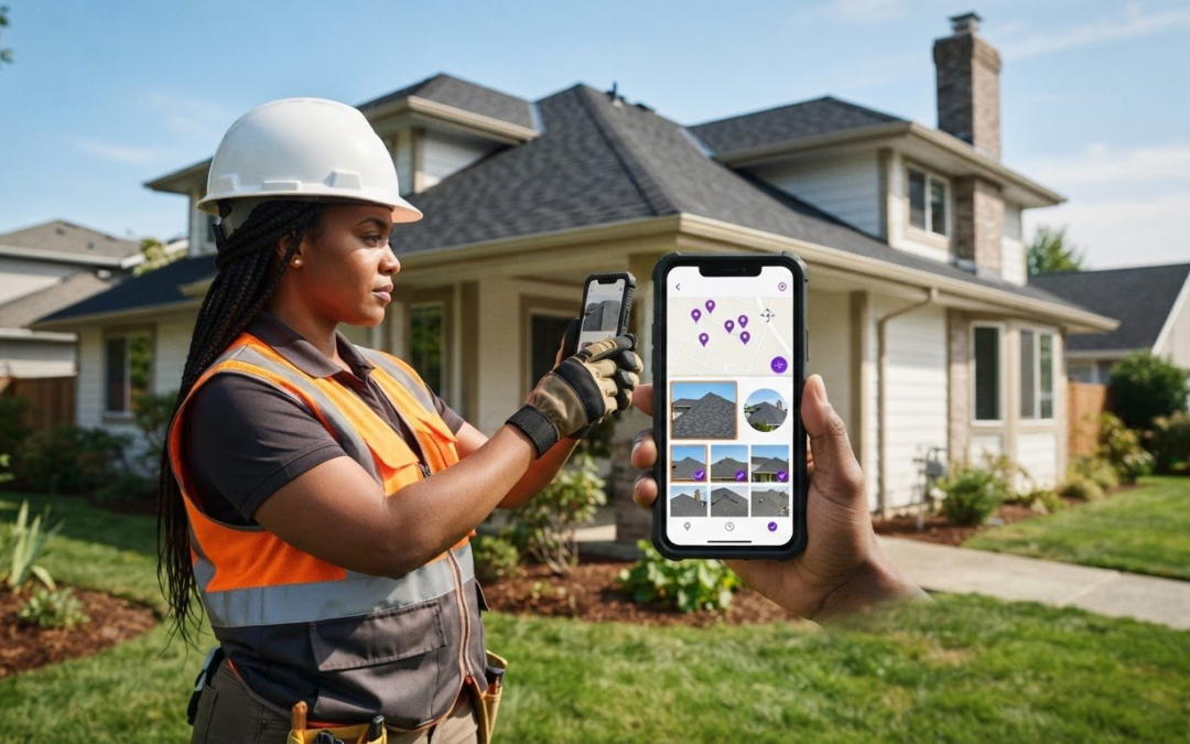
Burning a generic date stamp onto a camera roll snapshot won’t protect your business from a contested insurance claim or a frustrating client dispute. Basic watermarking utilities only alter surface pixels, leaving adjusters skeptical and field teams buried under unorganized files. To lock down bulletproof evidence, you need a dedicated photo timestamp and location app that verifies jobsite conditions without adding friction to your workflow. If you’re spending one to two hours every evening sorting through hundreds of camera roll photos and manually typing GPS coordinates, your documentation process is stealing your valuable time.
You already know the headache of adjuster pushback over missing dates or unclear room descriptions. Discover how a photo timestamp and location app protects your business, eliminates reporting disputes, and accelerates field documentation. In this 2026 field guide, you’ll learn how modern mobile solutions capture tamper-proof proof, automate photo labeling directly in the app, and generate client-ready inspection reports before you leave the jobsite.
Key Takeaways
- Understand why surface-level pixel watermarks fail modern adjuster scrutiny and how tamper-proof EXIF metadata creates indisputable proof for property claims.
- Discover the critical hardware-level features required for pinpoint GPS accuracy across individual roof planes, interior rooms, and exterior elevations.
- Calculate the hidden labor costs of sorting camera rolls manually and see how a dedicated photo timestamp and location app eliminates tedious desk work.
- Implement an airtight four-phase photo capture protocol to standardize site documentation and eliminate structural confusion across your field team.
- Learn how automated photo labeling and instant PDF report generation transform raw site photos into professional deliverables before you leave the jobsite.
What Is a Photo Timestamp and Location App and Why Do Field Teams Need It?
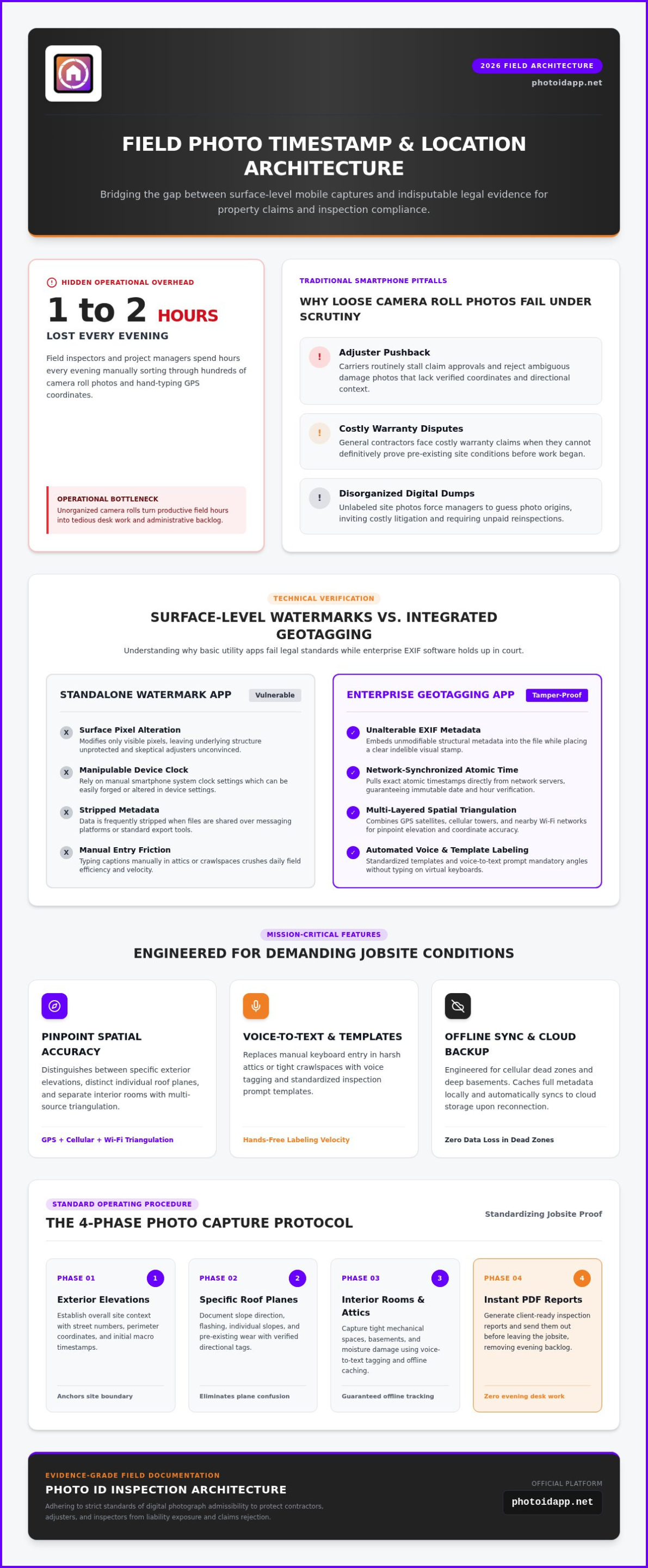
A photo timestamp and location app is specialized mobile software that captures, validates, and embeds geographic coordinates, network time, and directional context directly into jobsite images. Consumer camera apps often apply surface-level watermarks that alter visible pixels without safeguarding the underlying file structure. In contrast, enterprise inspection software records unalterable EXIF metadata while placing a clear, indelible stamp across the image. As field documentation standards tighten, a verified timestamp and location tag transforms a simple photo into indisputable legal evidence.
Insurance carriers, commercial lenders, and property owners nationwide now enforce rigorous photo documentation protocols. When field technicians upload raw smartphone captures lacking verifiable site coordinates, adjusters stall claim approvals and dispute repair scopes. Unverified images invite liability exposure, force unpaid reinspections, and create friction across projects. Professional teams need a photo timestamp and location app to turn everyday site photos into defensible operational proof.
The Mechanics of Geotagging and Time Verification
Modern field apps capture precise physical data by triangulating GPS satellites, cellular towers, and nearby Wi-Fi networks. This multi-layered process, broadly known as Geotagging, anchors every capture to real-world coordinates before a technician leaves the scene. Consumer camera rolls often hide this data in background menus or strip it entirely when images are shared across messaging apps. Even worse, standard smartphone clocks rely on manual device settings that anyone can manipulate. Enterprise inspection tools pull atomic time directly from network-synchronized servers, guaranteeing that the recorded date and hour remain fully authentic.
Why Traditional Smartphone Photos Fail in High-Stakes Industries
Generic camera snapshots create massive vulnerabilities across high-stakes field environments:
- Adjuster pushback: Insurance adjusters routinely reject ambiguous damage photos that lack verified coordinates and directional context.
- Warranty disputes: General contractors face costly warranty claims when they cannot prove pre-existing site conditions before work began.
- Disorganized digital dumps: Unlabeled camera rolls force project managers to spend hours deciphering where and when photos were taken, inviting costly litigation.
Capturing loose photos without verified location stamps creates operational risk. Deploying a structured field tool protects your crew, clarifies conditions, and secures immediate proof.
Critical Features to Demand in a Professional GPS Timestamp Camera App
Consumer utility apps focus on decorative fonts and colorful overlays. Enterprise field documentation demands structural integrity and exact spatial intelligence. A professional photo timestamp and location app must deliver pinpoint GPS precision that distinguishes between specific building elevations, separate interior rooms, and distinct roof planes. Legal defensibility requires rigorous standards, and federal research on the admissibility of digital photographs highlights how verifiable authenticity prevents claims of visual manipulation. Selecting tools engineered for technical compliance guarantees your evidence stands up to intense legal and insurance scrutiny.
Automated Labeling and Custom Inspection Templates
Typing descriptions on a virtual keyboard inside a sweltering attic or tight crawlspace ruins field productivity. Professional tools replace manual text entry with voice-to-text labeling and custom inspection templates that prompt technicians through mandatory angles. Implementing standardized naming conventions prevents confusion between multiple field technicians and trade contractors. Pairing automated tags with the best home inspection app accelerates field velocity, ensuring your crews capture comprehensive documentation on every site visit.
Offline Synchronization and Cloud Backup Security
Field inspections frequently take teams into cellular dead zones, deep basements, and remote rural properties. Your photo timestamp and location app must offer robust offline caching that preserves high-resolution files and verified satellite coordinates without an active data signal. The moment your mobile device reconnects to a network, background synchronization should upload assets to secure cloud storage. Built-in permission controls prevent accidental file deletion and preserve an unbroken chain of custody across your organization.
Instant Report Compilation Capabilities
Dumping raw, unorganized photos into shared cloud folders leaves hours of administrative work for the evening. Professional platforms solve this bottleneck by compiling stamped, categorized photos into client-ready PDF reports directly on your mobile device. Delivering polished, branded inspection summaries before leaving the driveway establishes instant commercial authority. If you want to streamline your field documentation from capture to final summary, explore how PHOTO iD transforms your onsite workflow.
Standalone Watermark Utilities vs. Integrated Inspection Documentation Software
Single-function stamping tools solve only half the documentation equation. They stamp coordinates onto an image, but they dump the resulting file directly into your device’s native camera roll. When an inspection generates 200 photos, someone must manually rename files, sort images into desktop folders, and match snapshots to specific rooms. That manual file shuffle drains 1 to 2 hours of evening desk work per inspection. A basic visual stamp proves a picture was taken somewhere, but it fails to communicate damage severity, component type, or project context.
Modern field operations demand an integrated approach. While a standalone utility stops at image creation, a dedicated photo timestamp and location app bridges field capture with real-time office oversight. It structures your data during the walk, turning raw visual assets into actionable project intelligence.
The Limitations of Single-Purpose Consumer Stamp Apps
Basic consumer watermarking utilities create operational bottlenecks across growing field teams:
- Gallery chaos: Hundreds of jobsite photos mix with personal pictures, making specific site photos difficult to retrieve during disputes.
- Batch sharing failure: Distributing high-resolution image batches via email or messaging apps compresses files, stripping essential metadata.
- Broken chain of custody: Freeware apps lack tamper-proof audit trails, making it impossible to verify which technician captured an image or when it was synced.
Without structured data intake, simple stamps quickly become an administrative nightmare.
The ROI of End-to-End Field Inspection Platforms
Switching from a generic utility to an integrated documentation platform delivers immediate operational returns. By automating file sorting and labeling during site walks, field teams eliminate 10 to 15 hours of post-inspection administrative burden every week. Technicians spend less time behind a computer screen and more time completing billable inspections. Standardized data flows align seamlessly with the systems outlined in our construction management software guide.
Accelerated workflows translate directly into rapid financial clearance. Project stakeholders approve estimates faster when field evidence is structured, labeled, and instantly available. Using an enterprise-grade photo timestamp and location app transforms image capture from an unorganized daily chore into an efficient competitive advantage.
How Field Teams Implement Standardized Geotagged Photo Protocols
Ad hoc photography ruins jobsite clarity. When technicians capture photos at random angles without a clear sequence, office teams struggle to reconstruct the scene. Implementing a standardized four-phase capture protocol brings total consistency to every site inspection:
- Phase 1: Overview. Capture wide-angle establishing shots of the entire property, street view, and address identification.
- Phase 2: Context. Document specific structural elevations, room layouts, and immediate architectural surroundings.
- Phase 3: Close-Up. Focus tightly on individual defects, mechanical tags, or material transitions.
- Phase 4: Verification. Capture reference measurements, moisture readings, and completed punch-list repairs.
Locking this sequence into a dedicated photo timestamp and location app ensures every technician follows the exact same standard, eliminating documentation gaps across your entire organization.
Setting Up Systematic Site Capture Hierarchies
Never let a technician shoot micro-defects before capturing wide orientation frames. Without contextual backing, a close-up photo of cracked siding or hail impact on a shingle provides zero spatial reference. Enforce a strict perimeter route, moving clockwise around the exterior envelope to guarantee full coverage. Mandate cardinal compass directions alongside latitude and longitude. For symmetrical commercial structures, identical suburban tract homes, or repeating hotel corridors, compass bearings eliminate costly confusion between opposite elevations.
Team Alignment and Centralized Quality Assurance
Traditional field inspections leave quality review until the following business day, when missed shots require an expensive truck roll. Modern platforms connect the field directly to the office. Centralized management dashboards allow QA managers to review incoming photo streams in real time while the technician remains on the property. If an image lacks clear focus or a required elevation shot is missing, the office triggers an instant alert. Catching documentation errors before your vehicle leaves the curb eliminates re-trip costs and accelerates final approvals. Equip your team with PHOTO iD today to deploy standardized inspection protocols that keep every project on schedule and fully verified!
Why PHOTO iD Is the Ultimate Photo Timestamp and Location App for Modern Inspectors
Generic camera utilities treat jobsite photography like casual vacation snapping. PHOTO iD was engineered from the ground up as a comprehensive documentation engine. By merging high-precision GPS verification with automated workflow intelligence, PHOTO iD operates as the definitive photo timestamp and location app for modern field professionals. Instead of spending your evenings dragging files across desktop folders, the platform automates photo cataloging directly into organized project categories as you walk the site.
Field inspectors don’t have time to peck out notes on a touchscreen while balancing on a steep pitch or inspecting tight crawlspaces. PHOTO iD features patented voice-to-text technology engineered specifically to recognize specialized inspection and construction terminology. Speak your observations naturally, and the app transcribes accurate captions, stamps verified network time and coordinates, and embeds the data into the photo record. Every visual capture becomes an audit-proof asset before you take your next step.
Engineered by Industry Veterans for Jobsite Reality
Founded by industry veteran Ken Perry (“The Claims Coach”) through parent company U.S. Pro-Adjusters, LLC, PHOTO iD addresses the physical realities of onsite assessments. The mobile interface is built for intuitive single-hand operation, allowing technicians to capture critical evidence while keeping one hand free for ladders, flashlights, or tools. It functions reliably across harsh environments where speed, personal safety, and data accuracy cannot be compromised.
From Camera Click to Finished Client Report in Minutes
Documentation should never create an administrative bottleneck. With PHOTO iD, your onsite workflow moves in a rapid, logical rhythm:
- Capture: Snap clear structural evidence with exact GPS coordinates and directional context.
- Speak: Dictate detailed defect descriptions using specialized speech recognition.
- Generate: Compile polished, client-ready PDF inspection reports in seconds.
Back at the office, supervisors monitor multiple field teams using the centralized web dashboard, reviewing photo streams in real time for instant quality control. This seamless collaboration eliminates administrative drag, prevents payment disputes, and protects your operational margins. Reclaim your evenings and elevate your inspection standards by getting started with PHOTO iD today!
Upgrade Your Field Documentation and Reclaim Your Evenings
Relying on basic watermark utilities leaves your business vulnerable to disputed claims, delayed approvals, and wasted hours behind a computer screen. Modern operations demand indisputable proof. By equipping your crew with a dedicated photo timestamp and location app, you ensure every image contains verified spatial data, exact network timestamps, and clear architectural context before anyone steps foot off the jobsite.
Built by industry veterans who understand daily jobsite documentation demands, PHOTO iD redefines field efficiency. Speak your findings naturally using integrated voice-to-text labeling tailored specifically for field trades and inspectors, organize photos automatically during capture, and use the instant photo report builder to transform raw field shots into professional PDFs. Protect your margins, eliminate evening administrative drag, and give your clients absolute confidence in your work. Start capturing indisputable field proof with PHOTO iD today!
Frequently Asked Questions
Can photo timestamp and location data be faked or manually altered on standard smartphones?
Yes, native smartphone galleries and basic camera tools allow users to alter time and location settings manually. Certain mobile operating systems let users edit photo dates, times, and map pins with just a few taps. A dedicated photo timestamp and location app prevents manipulation by pulling tamper-proof network time from cellular networks and cross-referencing satellite telemetry, ensuring the data remains legally defensible.
What is the difference between EXIF metadata and an on-screen visual timestamp stamp?
An on-screen visual stamp permanently burns visible text directly onto the image pixels, making key data instantly readable without technical software. EXIF metadata embeds hidden technical records inside the image file, including camera settings, raw GPS coordinates, and capture dates. Professional inspection tools combine both formats so anyone reviewing the file can view immediate on-screen proof while technical auditors verify backend file integrity.
Does a photo timestamp and location app still work inside basements or metal buildings without GPS signal?
Yes, an enterprise photo timestamp and location app continues functioning seamlessly when physical structures block satellite reception. When GPS signals drop inside subterranean levels or steel-framed facilities, the software uses offline caching and directional data from the last confirmed perimeter reading. Once your mobile device reconnects to a network, the platform synchronizes all captured assets and verification records to cloud storage without corrupting the documentation timeline.
How does an automated photo labeling app save time compared to standard phone cameras?
Standard camera apps force you to sort hundreds of mixed photos into desktop folders, eating up hours of evening desk work. An automated photo labeling platform categorizes images as you walk the site. By utilizing patented voice-to-text recognition built for trade terminology, inspectors dictate findings instantly. Photos are automatically named, tagged, and assigned to specific project categories, eliminating manual post-inspection data entry entirely.
Why do insurance carriers and adjusters demand geotagged and timestamped photos?
Insurance carriers demand verifiable proof to eliminate fraudulent claims and confirm that documented damage matches active policy periods and verified locations. With the widespread emergence of advanced image manipulation tools, adjusters require tamper-proof digital evidence. Geotagged and timestamped captures provide an indisputable chain of custody, proving exactly when and where conditions were recorded, which speeds up claim reviews and contractor payouts.
Can I share geotagged photo reports directly with clients from my smartphone?
Yes, modern inspection software compiles your stamped, labeled photos into client-ready PDF summaries directly from the field. Rather than returning to an office to assemble a document, technicians tap a button to generate professional reports complete with timestamps, GPS data, and defect notes. You can email or message branded reports to adjusters, managers, or homeowners before driving away from the property.
Will high-resolution stamped photos consume all the internal storage space on my mobile device?
No, enterprise documentation platforms prevent internal device clutter by leveraging automated cloud synchronization. High-resolution images process on your phone and upload to secure cloud servers whenever a connection is present. This architecture frees up internal device memory, protects data if a device is damaged in the field, and allows central management teams to access full-resolution files instantly from the office dashboard.