
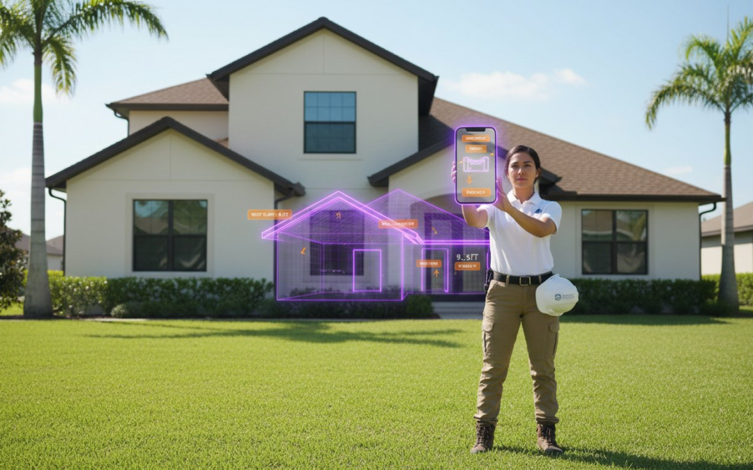
How much is your safety worth on a 10/12 pitch roof when a single slip could end your career? Every field professional knows the frustration of balancing on a ledge while trying to capture aerial roof and wall measurements manually. It’s a dangerous, slow, and outdated process that often adds 30 minutes of unnecessary sketching to every single claim. You deserve a workflow that keeps your boots on the ground and your data 100 percent accurate.
We’re here to help you work smarter. By leveraging the right technology, you’ll eliminate ladder risks, ensure claim-ready accuracy, and slash your inspection time by 50 percent. No more manual sketches. No more disorganized photos. Just pure efficiency. This guide reveals how to generate professional, carrier-ready reports instantly. Stop climbing. Start clicking. It’s time to streamline your workflow, protect your team, and maximize your daily output. Snap, speak, and send your way to a more profitable workday today.
Key Takeaways
- Stop risking dangerous ladder falls and start using remote sensing to eliminate jobsite liability.
- Harness the power of 3D photogrammetry to capture precise aerial roof and wall measurements with claim-ready accuracy.
- Import property geometry directly into Xactimate or Symbility to satisfy carrier requirements and speed up estimates.
- Utilize the “Snap, Speak, Send” workflow to effortlessly organize and label your measurement-related imagery.
- Discover how to slash your inspection time in half and transform chaotic field data into professional reports instantly.
What are Aerial Roof and Wall Measurements?
Stop risking your life on a 40 foot ladder just to pull a tape measure. Aerial roof and wall measurements represent the modern standard for property inspections. These are high resolution remote sensing data packages that capture the exact geometry of a building. You get a digital blueprint without ever leaving the ground. This technology replaces the slow, dangerous manual methods of the past with satellite and drone based precision. It’s about reclaiming your time and ensuring your data is bulletproof.
This isn’t just a luxury for tech enthusiasts. It’s the primary tool for roofing contractors, insurance adjusters, and restoration pros who need to move fast. In an industry where time is money, these measurements deliver three core values:
- Unmatched Speed: Generate full property reports in under 24 hours.
- Total Safety: Keep your boots on the pavement and off the shingles.
- Undeniable Accuracy: Eliminate human error and manual math mistakes instantly.
By leveraging aerial roof and wall measurements, you provide a level of transparency that builds immediate trust with homeowners and carriers. No more disputes over square footage. No more wasted materials. Just pure, actionable data delivered right to your device!
The Evolution of Remote Property Data
The industry has come a long way since the low resolution satellite images of 2005. We’ve shifted from grainy overhead shots to sophisticated 3D photogrammetry. This process uses overlapping photos to create a precise mathematical model of the structure. Modern imagery allows for sub inch accuracy in over 95% of standard weather conditions. AI algorithms now do the heavy lifting by identifying roof facets, pitches, and wall boundaries with incredible consistency. This evolution means you can trust the software to catch details that the human eye might miss during a rushed site visit.
Roof vs. Wall Measurements: Why You Need Both
A complete estimate requires more than just a roof plane. Roof measurements focus on the top down geometry. You get precise data for eaves, ridges, valleys, rakes, and the exact pitch of every facet. This ensures your shingle counts are perfect every time. Wall measurements take it a step further by calculating total surface area, identifying window and door openings, and determining siding requirements. When you combine both, you get a total building envelope estimate. This holistic view allows you to bid larger restoration projects with total confidence. A Picture is Worth a 1000 Words! These digital models provide the visual proof you need to settle claims and close deals faster. Snap, Speak, Send your way to a more profitable jobsite today.
The Tech Behind the Precision: How Aerial Data Works
Stop guessing and start measuring. Modern aerial roof and wall measurements rely on multi-view photogrammetry to turn flat images into intelligent 3D models. This tech captures a property from dozens of different angles, overlapping pixels to create a dense point cloud. It doesn’t just show a roof; it reconstructs the entire geometry of the structure. High-resolution sensors capture minute details that the human eye might miss from the ground. You can clearly identify flashing, vents, and ridge caps without ever pulling a ladder off your truck.
Precision is the priority. While the software is powerful, the best results often incorporate “ground truth” verification for complex structures. This ensures that tree overhang or deep shadows don’t compromise your estimate. Reliability is backed by rigorous standards. Many inspectors look to NIST performance tests to understand how aerial robots and sensors maintain accuracy in diverse field conditions. Whether you’re in a dense urban center or a rural landscape, the data remains consistent, repeatable, and claim-ready.
Satellite vs. Drone-Based Measurements
Speed meets detail. Satellite imagery is the king of cost-effectiveness and rapid turnaround. It’s the perfect choice for standard residential claims where clear overhead views are available. You get the data you need in minutes. When you face complex commercial walls or heavy tree canopies, drones take the lead. They provide granular, high-velocity detail that satellites can’t match. Choose satellites for volume; choose drones for complexity. Both methods streamline your documentation workflow effortlessly.
Converting Imagery into 3D Estimating Sketches
The transition from image to estimate is seamless. Software “sketches” vector data directly over the aerial imagery to define edges and facets. Pitch isn’t a guess anymore. By using stereoscopic image pairs, the tech calculates slopes and heights with mathematical certainty. The final output arrives in formats you already use. Import ESX, XML, or PDF files directly into your estimating platform. It’s a simplified process that eliminates manual entry errors and saves hours of desk time.
- Snap: Capture high-resolution aerial perspectives.
- Calculate: Let photogrammetry define the dimensions.
- Export: Drop vector data straight into Xactimate or Symbility.
A picture is worth a 1000 words, but a 3D model is worth a thousand accurate measurements. This technology restores order to the chaos of field inspections. It’s about working smarter, staying safe, and delivering professional results every single time. Trust the tech, verify the data, and close your files faster than ever before.
Claim-Ready Accuracy: Integrating with Xactimate and Symbility
Manual sketches are a liability. They invite scrutiny, cause friction, and delay your payments. Most insurance carriers now prioritize third-party data because it provides an objective source of truth. When you use aerial roof and wall measurements, you remove the bias from the equation. This professional transparency eliminates the “Supplement” cycle that bogs down your cash flow. Stop the endless back-and-forth emails with adjusters. Accurate data ensures your first estimate is your final estimate. It’s about building trust through precision.
Estimating Software Data Integration
Import your data directly into your estimating software. Don’t waste another minute recreating sketches facet-by-facet in your preferred estimating software. Use industry-standard data files (e.g., XML) to populate your estimate tree instantly. This process streamlines your entire documentation workflow and keeps your projects moving forward. It removes the risk of “fat-finger” errors that happen during late-night manual entry. A pre-built sketch saves an average of 45 to 60 minutes per claim. That’s time you can spend closing the next deal instead of fighting with software. Snap, Speak, Send!
Overcoming Carrier Objections to Remote Data
Address skepticism with hard evidence. Use 3D renderings to justify material waste factors on complex hip roofs or multi-level structures. If an adjuster questions a measurement, show them the high-resolution imagery used to generate the report. Document “unseen” damage like flashing issues or hidden valleys with ground-level photos to complement your aerial roof and wall measurements. This transparency builds massive rapport with both carriers and homeowners. It proves you aren’t just guessing; you’re measuring with intent. Remember, A Picture is Worth a 1000 Words!
- Confirm all facets have assigned pitch values for accurate waste.
- Ensure North-up orientation matches actual site conditions.
- Identify and label all penetrations like vents, pipes, and chimneys.
- Validate that waste calculations align with IICRC standards for material type.
- Cross-check aerial data against at least two manual ground-level check measurements.
- Include high-resolution 3D renderings in the final claim package.
Efficiency is the only way to scale in this industry. By integrating aerial data directly into your workflow, you act as the Efficient Expert carriers want to work with. You reduce human error, speed up approvals, and restore order to the chaos of the jobsite. Pairing your aerial data with the right roof software built for scaling your business is the ultimate combination for maximizing your output and profitability. It is a game-changing partner for your business growth.
Field Safety Protocols: Reducing Liability on the Jobsite
Safety isn’t just a checkbox. It’s your bottom line. According to OSHA 2022 data, falls remain the leading cause of death in construction, accounting for 39.2% of total fatalities. Every time a worker scales a ladder for a manual estimate, your liability skyrockets. Utilizing aerial roof and wall measurements allows you to keep your boots on the ground while capturing every dimension with surgical precision. It’s time to stop risking lives for simple documentation. Remote data isn’t just a convenience; it’s a shield for your business and your crew.
The Virtual Inspection Advantage
Pre-screen every property before your truck even leaves the driveway. High-resolution virtual inspection tools let you identify high-risk areas like overhead power lines or crumbling chimneys from your office. Spot a 12/12 pitch or brittle, sun-damaged clay tiles? Designate these as “no-climb” zones immediately. This proactive approach does more than save lives. It saves significant capital. Contractors who consistently use remote data can often negotiate lower insurance premiums by lowering their Experience Modification Rate (EMR). You’re proving to carriers that you’ve eliminated the primary cause of workers’ compensation claims: the fall.
Best Practices for Safe On-Site Verification
Verification shouldn’t involve a harness or a risky climb. Use high-zoom photography to confirm aerial roof and wall measurements from the safety of the perimeter. Our “Snap, Speak, Send” method transforms how you document these details. Stand back, capture the eave or the flashing, and use voice-to-text labeling to note any discrepancies instantly. This keeps your eyes on your surroundings, not buried in a notepad. You get the data you need without the height-related hazards that lead to costly accidents. It’s fast. It’s safe. It’s professional.
- Identify brittle materials like slate or aged asbestos tiles that can’t support foot traffic.
- Document steep slopes using ground-based zoom photography to avoid unnecessary climbing.
- Label all measurements using voice commands to maintain constant situational awareness on-site.
- Create a digital paper trail that proves a “safety-first” culture to your insurance provider.
Don’t let a single slip derail your company’s future. Streamline your safety workflow and protect your crew with the ultimate field documentation partner. Secure your jobsite with PHOTO iD today!
Snap, Speak, Send: Streamlining Your Workflow with PHOTO iD
Safe inspections start with keeping your feet on the ground, but professional results require a bridge between raw data and a finished report. PHOTO iD serves as that vital link. It transforms aerial roof and wall measurements into organized, client-ready documentation without the manual headache. You’ve captured the data; now it’s time to make it work for you. Our automated photo labeling system organizes every image the moment you take it, ensuring your measurement-related imagery is never lost in a cluttered camera roll.
The days of spending hours at a desk after a long day in the field are over. PHOTO iD enables instant report generation that pulls in your measurement data automatically. It is a seamless transition from the jobsite to the final submission. You get to maintain a safe distance from steep pitches while still delivering a high-impact, technical breakdown. Stop climbing, start clicking, and let the technology handle the heavy lifting.
Integrating Measurements into Your Photo Reports
Efficiency thrives on organization. With PHOTO iD, you can effortlessly attach your aerial reports directly to your labeled field photos. This creates a unified file that provides a 360-degree view of the property. The team management dashboard keeps your entire crew on the same page, allowing managers to review progress in real-time. We believe that A Picture is Worth a 1000 Words! Every report we generate emphasizes this philosophy, providing clear, annotated visual evidence that supports your aerial roof and wall measurements and eliminates any room for dispute.
The ROI of a Unified Documentation Platform
Time is your most valuable asset during a busy storm season. Field professionals using a unified platform see a massive reduction in administrative tasks. By combining measurements and photos into one workflow, you can save 50% to 75% of the time typically spent on manual report writing. That is hours of reclaimed time every single week. Beyond the clock, the professional appearance of these reports sets you apart from the competition. You aren’t just sending a file; you’re sending a polished, authoritative document that screams expertise. It’s time to work smarter, stay safer, and maximize your earnings on every claim.
Ready to revolutionize your inspection process? Streamline your inspections with PHOTO iD now!
Take Control of Your Inspection Workflow
Stop climbing dangerous ladders and start closing claims faster. Precise aerial roof and wall measurements aren’t just a luxury; they’re the new industry standard for safety and accuracy. By utilizing technology founded by Ken Perry, “The Claims Coach,” you eliminate the liability of manual measuring while ensuring claim-ready data every single time. You’ve seen how seamless Xactimate image import and instant report generation can transform your daily grind. It’s time to replace the chaos of disorganized folders with a streamlined, professional workflow that works as hard as you do.
Efficiency isn’t about working harder. It’s about working smarter with tools built specifically for the field. PHOTO iD helps you stay organized, labeled, and professional before you even leave the jobsite. Experience the power of our Snap, Speak, Send method and reclaim your valuable time. A Picture is Worth a 1000 Words! Take the leap toward a more profitable and safer career today.
Start Your Free Trial of PHOTO iD and Automate Your Documentation!
Your future inspections are faster, safer, and more accurate than ever before. Let’s get to work!
Frequently Asked Questions
How accurate are aerial roof and wall measurements compared to hand-measuring?
Aerial measurements are typically 95% to 99% accurate, matching or exceeding manual tape measurements. Using aerial roof and wall measurements eliminates human error from ladder fatigue or difficult pitch calculations. Trust these reports for exact material orders and labor estimates every time. Stop climbing; start scaling with data you can trust! Snap, Speak, Send your way to total precision!
Can I use aerial measurements for insurance claims in Xactimate?
Yes, you can import aerial measurement data directly into Xactimate to streamline your insurance claims. Most major carriers accept these reports as the gold standard for property dimensions. This integration allows you to generate estimates instantly and close files faster. It’s a game-changing partner for your estimating workflow! Stop wasting time on manual entry and start closing more claims today.
Do aerial reports include wall measurements for siding and gutters?
Comprehensive reports include full wall measurements for siding, windows, doors, and gutter lengths. You get a complete exterior breakdown without ever pulling a tape. Use these detailed insights to bid siding projects or gutter replacements with total confidence. A Picture is Worth a 1000 Words, but an aerial report provides the exact numbers! Streamline your bids and win more jobs with professional data.
What is the turnaround time for receiving an aerial measurement report?
Expect your aerial report in your inbox within 1 to 24 hours depending on the property complexity. Most standard residential reports arrive in under 4 hours. This speed allows you to respond to leads while the customer is still on the phone. Snap, Speak, Send your way to faster project approvals! Don’t let a slow measurement process cost you a signed contract.
Will aerial measurements work on properties with heavy tree cover?
Heavy tree cover can block visibility, but advanced 3D modeling often compensates for obstructed views. If the canopy covers more than 50% of the roof, manual verification might be necessary for specific sections. Check the preview before ordering to ensure clear visibility. Our technology handles most obstructions effortlessly to keep you on the ground! Experience the relief of safe, remote inspections even on wooded lots.
How much can I save by using aerial measurements instead of manual inspections?
You can save 2 to 3 hours per inspection by eliminating the need for manual measurements. According to industry data, field technicians spend 45% of their time on-site just capturing dimensions. Using aerial roof and wall measurements reduces that time to zero. Reclaim those hours and increase your daily inspection volume by 30% or more! It’s the ultimate way to boost your annual revenue.
Is a subscription required to access aerial measurements through PHOTO iD?
Accessing aerial measurements through PHOTO iD requires an active account to manage your credits and reports. You can choose plans that fit your specific volume, from occasional users to high-volume firms. Sign up to centralize your documentation and measurement data in one powerful app. Streamline your business and stop juggling multiple platforms! It’s the smart way to manage your field work.
Can I get aerial measurements for commercial and multi-family buildings?
Aerial measurements work perfectly for large-scale commercial complexes and multi-family housing units. Our system processes structures up to 100,000 square feet with the same precision as a single-family home. Tackle big jobs without the risk of high-altitude ladder work. It’s the ultimate solution for large-scale property documentation! Expand your service offerings and bid on massive commercial projects with absolute certainty.