
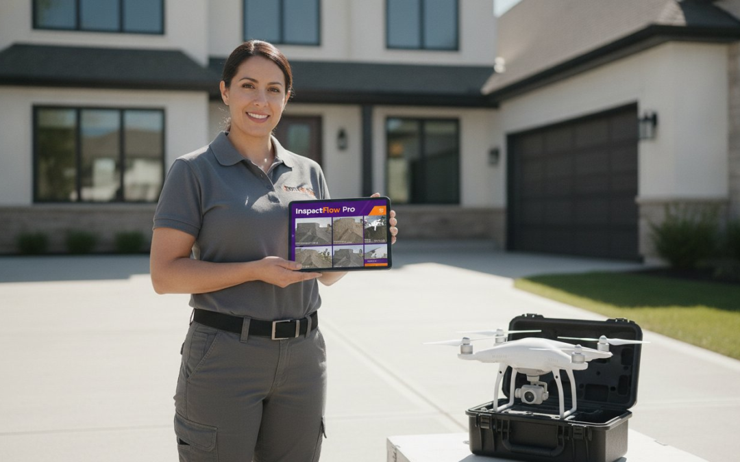
Collecting hundreds of high-resolution aerial images is the easiest part of your job. It’s also the fastest way to kill your profit margins if you’re still labeling those files by hand. You made the switch to drone photography for property inspections to stay off dangerous ladders and slash your onsite time. Yet, the “data dump” of 200 unlabeled photos per site often creates a new kind of chaos. It’s a digital bottleneck that turns a quick flight into a grueling afternoon of manual administrative work.
You deserve a process that’s fast, fluid, and flawless. This guide teaches you how to bridge the gap between capturing data and delivering results. We’ll show you how to eliminate manual photo labeling entirely and generate professional, instant reports that win more business. Stop drowning in files and start scaling your operations. It’s time to restore order to your documentation and reclaim your workday.
We’ll dive into the 2026 FAA Part 107 requirements, break down the latest Remote ID enforcement standards, and reveal the software secrets that turn raw imagery into actionable intelligence. Get ready to transform your inspection business into a high-velocity reporting machine!
Key Takeaways
- Stop climbing roofs and start flying. Learn how drone photography for property inspections slashes liability and reduces insurance premiums instantly!
- Stay compliant and flight-ready. Get the quick facts on 2026 FAA Part 107 requirements and the essential hardware specs you need for high-resolution data.
- Kill the post-flight data dump. Master automated photo labeling to turn hundreds of generic files into a structured, professional report in seconds.
- Execute like a pro every time. Use custom templates and systematic flight paths to capture every angle without missing a single point of interest.
- Sync your team and your software. Discover how seamless Xactimate integration and real-time dashboards keep your entire operation moving at top speed!
Why Drone Photography for Property Inspections is the New Industry Standard
Manual inspections are a relic of the past. Today, a professional drone property inspection utilizes Unmanned Aerial Systems (UAS) to capture high-resolution site data with surgical precision. It’s not just a trend; it’s a fundamental shift in how field professionals document reality. By deploying a drone, you’re choosing a workflow that prioritizes safety, speed, and absolute clarity. You aren’t just taking pictures. You’re capturing a digital twin of the property.
Experience the power of data velocity. While a traditional inspector might spend two hours hauling heavy ladders and navigating dangerous shingles, a skilled pilot can clear a site in twenty minutes. This efficiency allows you to scale your operations instantly. You can move from two inspections per day to eight or more. More sites. More data. More revenue! This is how you outpace the competition and satisfy demanding carriers.
The human eye has physical limits. 4K drone imagery doesn’t. We’re currently in the middle of a resolution revolution where digital sensors catch hairline cracks and subtle hail strikes that a person standing on the roof would likely miss. It’s about seeing more, knowing more, and proving more. When you use drone photography for property inspections, you’re providing a level of evidence that manual methods simply can’t match.
The Safety and Liability Argument
Keep your boots on the ground. Eliminating roof climbs directly slashes your liability and can lead to significant reductions in insurance premiums. You no longer need to worry about workers compensation claims or the physical toll of specialized labor. Drones easily reach steep-pitch gables and high-rise chimneys that would otherwise require expensive, specialized rigging. Best of all, it’s non-invasive. You’ll never crack a brittle tile or damage a client’s property just by walking on it. Inspect. Protect. Prosper.
Capturing Superior Evidence for Claims
Context is everything in the claims world. An aerial perspective reveals broad patterns of damage, such as specific wind uplift signatures, that are completely invisible from a ladder. This bird’s-eye view is essential for UAV Applications in Inspections because it provides the full story of a loss in a single frame. Advanced pilots even use thermal sensors to pinpoint moisture trapped under flat roof membranes before it becomes a structural disaster. To tie it all together, drone-based photogrammetry is the process of turning these 2D photos into 3D measurable models for pinpoint accuracy. It’s the ultimate tool for drone photography for property inspections, turning raw visual data into a powerful, measurable asset.
The Drone Inspection Toolkit: Hardware, Regulations, and Software
Success in the field starts with the right gear. To deliver professional results, your hardware must meet a specific baseline. Forget toy-grade equipment. You need a GPS-stabilized platform equipped with at least a 20MP camera to capture the fine details of shingles, flashing, and masonry. High-resolution sensors are the industry standard for drone photography for property inspections because they allow you to zoom in on damage without losing clarity. The drone is your eye in the sky, but it’s only as effective as the system supporting it.
The bird is just one piece of the puzzle. Your software stack is the engine that drives your business forward. Modern Drone Inspection Market Trends highlight a shift where data management is now as critical as the flight itself. If your app doesn’t talk to your drone, you’re creating extra work for yourself. Streamline your workflow by using photo organization software that labels your captures the moment they hit your phone.
Navigating FAA Part 107 and Compliance
Commercial flight isn’t a hobby. If you’re getting paid, you must hold a valid FAA Part 107 Remote Pilot Certificate. In 2026, compliance is stricter than ever. Remote ID enforcement is fully active, meaning your drone must broadcast its identity and location in real-time. Use LAANC for instant airspace authorization when working near airports. Don’t risk your business on a quick flight without clearance. Always maintain digital flight logs to protect your operation during an audit. Fly legal. Fly safe. Fly smart!
Choosing the Right Inspection Drone
Match your tool to the task. Compact prosumer drones are perfect for residential roof inspections due to their portability and high-resolution cameras. However, complex commercial sites may require enterprise-grade platforms with thermal sensors to detect subsurface moisture. Look for drones with 360-degree obstacle avoidance. These sensors are lifesavers during close-proximity chimney or wall inspections. Finally, pack at least four batteries. High-velocity field work demands constant uptime, and you can’t afford to wait on a charger when there’s money on the table. Invest in quality hardware to ensure your drone photography for property inspections remains top-tier.
Solving the Drone Data Bottleneck: Automated Labeling and Organization
Capturing high-resolution imagery is a high-speed thrill. Sorting through it afterward is a high-speed headache. The absolute number one time-waster in drone photography for property inspections is the manual labor required to label and organize hundreds of files. When you land your drone, you often have a memory card filled with generic filenames like “IMG_0842.jpg.” Without a system, those files are just digital clutter. You need a workflow that turns raw data into a structured asset the moment it hits your device. Organize. Label. Report. That is the new standard for the modern professional.
Automated photo labeling is the game-changer you’ve been waiting for. It transforms a chaotic folder of unlabeled images into a categorized, professional inspection report instantly. By using a sophisticated photo app designed for the field, you eliminate the post-flight reporting bottleneck that keeps most inspectors chained to their desks. You didn’t become a drone pilot to spend your nights “desk adjusting” at a computer. You became a pilot to scale your business and dominate your market.
The Problem with Manual Documentation
Desk adjusting is the silent thief of your profit margins. Spending two hours every night manually labeling photos from five different sites is a nightmare. It’s tedious, it’s exhausting, and it’s dangerous for your business. When you handle 200+ photos per property, the risk of misidentifying damage is high. Mixing up a hail strike from one property with a wind loss from another can ruin your credibility with carriers. Slow reporting times also lead to lower customer satisfaction and longer claim cycles. Your clients expect speed. Manual sorting delivers the opposite.
How Automated Labeling Restores Order
Stop sorting and start automating. Custom inspection templates allow you to pre-categorize your drone photos as they are captured. This means every image is assigned to a specific room, elevation, or roof slope before you even leave the site. Voice-to-text labeling is the ultimate hands-free tool for drone pilots. Simply speak your findings while you hover. Say “Hail strike on south slope” or “Mechanical damage to chimney” and watch the software tag the image in real-time. PHOTO iD automates the organization of 200+ photos in seconds, ensuring every shot is perfectly placed for your final report. This is how you achieve the “Instant Report” promise. Generate a client-ready PDF before you even leave the driveway. Capture the data. Close the file. Move to the next job!
Step-by-Step: Executing a High-Velocity Drone Inspection
Speed in the field is a product of preparation. You don’t just launch and hope for the best. A high-velocity workflow for drone photography for property inspections starts before the propellers even spin. It requires a structured plan that eliminates guesswork and ensures every necessary angle is captured the first time. Efficiency is the bridge between a busy day and a profitable one. Stop winging it and start winning!
A repeatable process is your best defense against missed data. When you follow a systematic capture plan, you eliminate the need for costly re-inspections. Your goal is to move from arrival to departure in under thirty minutes while maintaining total documentation accuracy. This level of performance is only possible when your hardware and software work in perfect harmony. Capture. Label. Deliver. It’s that simple.
Pre-Flight Preparation and Template Setup
Select your mission profile before you leave the truck. Open your inspection app and choose the specific custom template for the job, such as a residential roof or a commercial wall assessment. Check your surroundings for signal interference in high-density areas and verify local wind speeds. Don’t forget your “Ground Truth” photos. Capturing standard, ground-level shots of the property address and all four elevations anchors your drone data and provides a complete narrative for the insurance carrier. Preparation prevents poor performance.
The Systematic Flight Pattern
Master the patterns to ensure total coverage. Use an orbital flight path to get a 360-degree overview of the structure and its surroundings. If your project requires 2D maps or 3D models, switch to a grid pattern to capture the necessary overlap for aerial roof and wall measurements. These measurements are vital for accurate estimating and material ordering. Once you’ve captured the big picture, move into the “Close-up” phase. Drop the drone lower to document specific defects like wind-torn shingles or cracked masonry with high-resolution detail. This systematic approach ensures drone photography for property inspections stays professional and thorough.
Documentation and Review
Document as you fly to save hours of desk work later. Use voice-to-text labeling to tag damage in real-time. Simply state the defect while hovering, and the software handles the organization. Before you pack up, use the team management dashboard to verify photo quality. Ensure every point of interest is clear and properly labeled while you are still on-site. This prevents the nightmare of returning to a property for a missed shot. Finish the job on-site by triggering an instant photo report generation while you’re still in the driveway. Sync to the cloud. Send to the client. Move to the next win!
Why PHOTO iD is the Essential Partner for Drone Inspection Teams
Chaos isn’t a requirement; it’s a choice. PHOTO iD isn’t just another app. It’s a game-changing partner built by industry veterans who’ve spent years in the dirt, on the roofs, and behind the reports. We understand the physical toll of field work and the mental drain of a 200-photo data dump. Our software exists to restore order to your documentation. It turns the complex capture of drone photography for property inspections into a streamlined, high-velocity asset. Stop fighting your tools. Start using a platform designed for your specific grind. Fly. Capture. Close!
Scaling Your Inspection Business with Team Tools
Management should be seamless. Our Team Management Dashboard provides real-time project oversight across your entire roster of pilots. You don’t need to be on-site to maintain quality control. From a single screen, a lead inspector can review photos from five different sites simultaneously. This centralized approach eliminates the nightmare of lost SD cards or broken file links. Everything is in the cloud. Everything is secure. Everything is ready. Move your team with precision and confidence.
Standardization is the secret to scaling. By using custom inspection templates, you ensure every pilot on your team follows the exact same documentation standard. No missed slopes. No blurry elevations. No excuses. Your brand is built on consistency, and our dashboard gives you the power to enforce it across every zip code you serve. Review the work. Approve the data. Move the mission forward! High-volume operations require high-velocity tools. PHOTO iD delivers the structure you need to grow without the growing pains.
Integration with Industry Standard Platforms
Speed wins the claim. For adjusters and contractors, the real value of drone photography for property inspections lies in how fast that data reaches the estimate. PHOTO iD photos and labels sync directly with Xactimate and Verisk. This seamless integration slashes the time spent on manual data entry and estimate creation. You aren’t just taking pictures; you’re building a digital bridge to a faster payout. Eliminate the friction between the field and the office. Sync. Settle. Succeed.
Professionalism sells. Our custom report builder allows you to generate branded, professional deliverables in seconds. Use the Instant Photo Report Generation feature to hand a polished PDF to a homeowner or carrier before you even pull out of the driveway. This isn’t just a report; it’s a competitive advantage that wins more business and builds long-term trust. Deliver results. Dominate the market. Drive growth.
Stop wasting time on manual labeling—start your PHOTO iD trial today!
Take Control of Your Inspection Future
The era of manual roof climbs and midnight photo labeling is over. You’ve seen how drone photography for property inspections slashes onsite time and eliminates unnecessary risks. By mastering the hardware and the software stack, you’ve positioned your business for massive growth. Remember, the true profit isn’t just in the flight; it’s in the speed of the result. Land the drone. Sync the data. Close the claim!
Our automated photo labeling saves you 2+ hours per report, allowing you to focus on the next job instead of the previous one. With built-in aerial roof and wall measurements, you can deliver precise estimates that carriers respect. It’s why we’re trusted by U.S. Pro-Adjusters and industry veterans alike. You have the skills. You have the drone. Now, you need the partner that makes it all work. It’s time to reclaim your workday and restore order to your documentation.
Streamline your drone inspections with PHOTO iD—Get Started Now!
Elevate your standards. Accelerate your reporting. Win your market!
Frequently Asked Questions
Do I need a special license for drone photography for property inspections?
Yes, you must hold a valid FAA Part 107 Remote Pilot Certificate to fly for any commercial purpose. The current testing fee is $175, and you must pass a knowledge test to prove you understand airspace regulations. This license is non-negotiable for anyone getting paid for drone photography for property inspections. Stay legal, stay insured, and protect your professional reputation!
How long does a typical drone property inspection take?
A standard residential site capture usually takes between 20 and 30 minutes. This includes your initial pre-flight safety check, the orbital flight for context, and the close-up phase for specific damage. Because you aren’t moving ladders or setting up fall protection, you can easily clear 8 or more sites in a single workday. Speed is your path to higher profits!
Can drones really see hail damage as well as a human on the roof?
High-resolution 4K sensors often detect subtle hail strikes and hairline cracks better than the naked eye. You can zoom in on 20MP still images to reveal microscopic fractures that an inspector standing six feet above the shingles might miss. Digital imagery provides a permanent, objective record that is impossible to ignore. Capture the truth. Prove the loss. Close the claim!
What is the best drone for property inspections in 2026?
The DJI Mavic 3 Enterprise is the current industry gold standard for high-volume professional work. For those just entering the market, the DJI Mini 4 Pro offers exceptional 4K HDR quality starting at $759. Both platforms provide the GPS stability and obstacle avoidance sensors required to navigate tight spaces around chimneys and gables safely.
How do I organize hundreds of drone photos for a single report?
Use automated photo labeling to categorize your images the moment they are captured. Instead of manually renaming generic files like “IMG_001.jpg” at your desk, use a professional photo app to tag images by slope or elevation during the flight. This turns a chaotic data dump into a structured report in seconds. Stop sorting. Start automating. Save time!
Are drone inspections accepted by insurance companies for claims?
Yes, major carriers and adjusters now prefer drone data because it’s safer, faster, and more objective than traditional methods. Providing clear aerial perspectives alongside automated, labeled reports speeds up the approval process significantly. It’s the new standard for drone photography for property inspections across the entire insurance industry.
What happens if the drone loses signal during a property inspection?
Professional drones use “Return to Home” (RTH) technology to automatically fly back to their takeoff point if the signal is interrupted. Modern obstacle avoidance sensors also help the aircraft navigate around trees or structures during this process. Most signal drops are brief and manageable. Stay calm, maintain line of sight, and let the hardware’s built-in safety features handle the recovery.
How much does drone inspection software like PHOTO iD cost?
Pricing for our mobile app subscription is based on your team size and the volume of reports you generate. We offer flexible plans designed to scale alongside your business as you move from a solo pilot to a full team. Check our website for current subscription options and start your trial to experience the ROI of automated reporting firsthand!